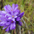
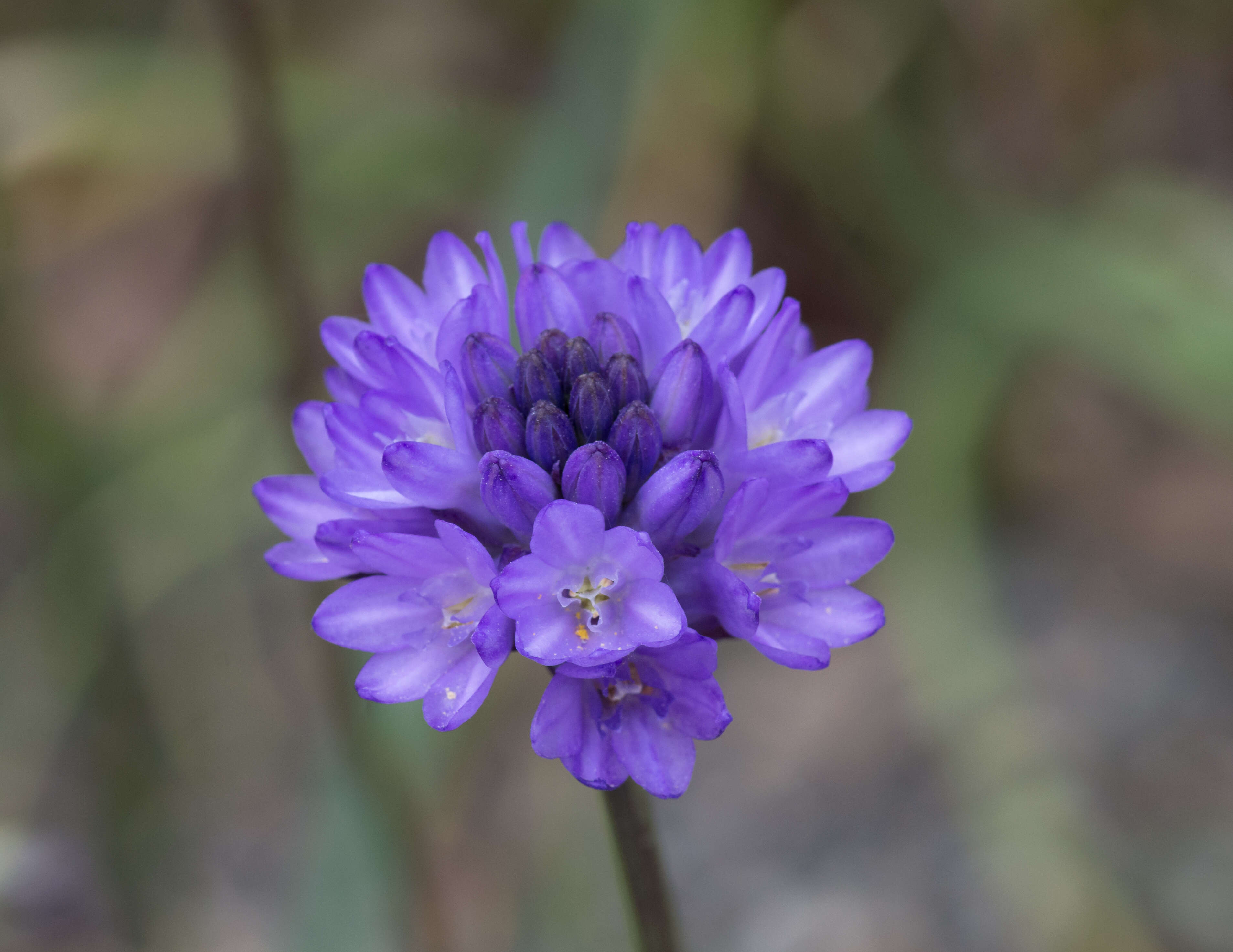
Description: Harvest lily (Brodiaea congesta) You are free to use this image with the following photo credit: Peter Pearsall/U.S. Fish and Wildlife Service. Date: 18 December 2015, 09:20. Source: brodiaea_congesta. Author: USFWS - Pacific Region.
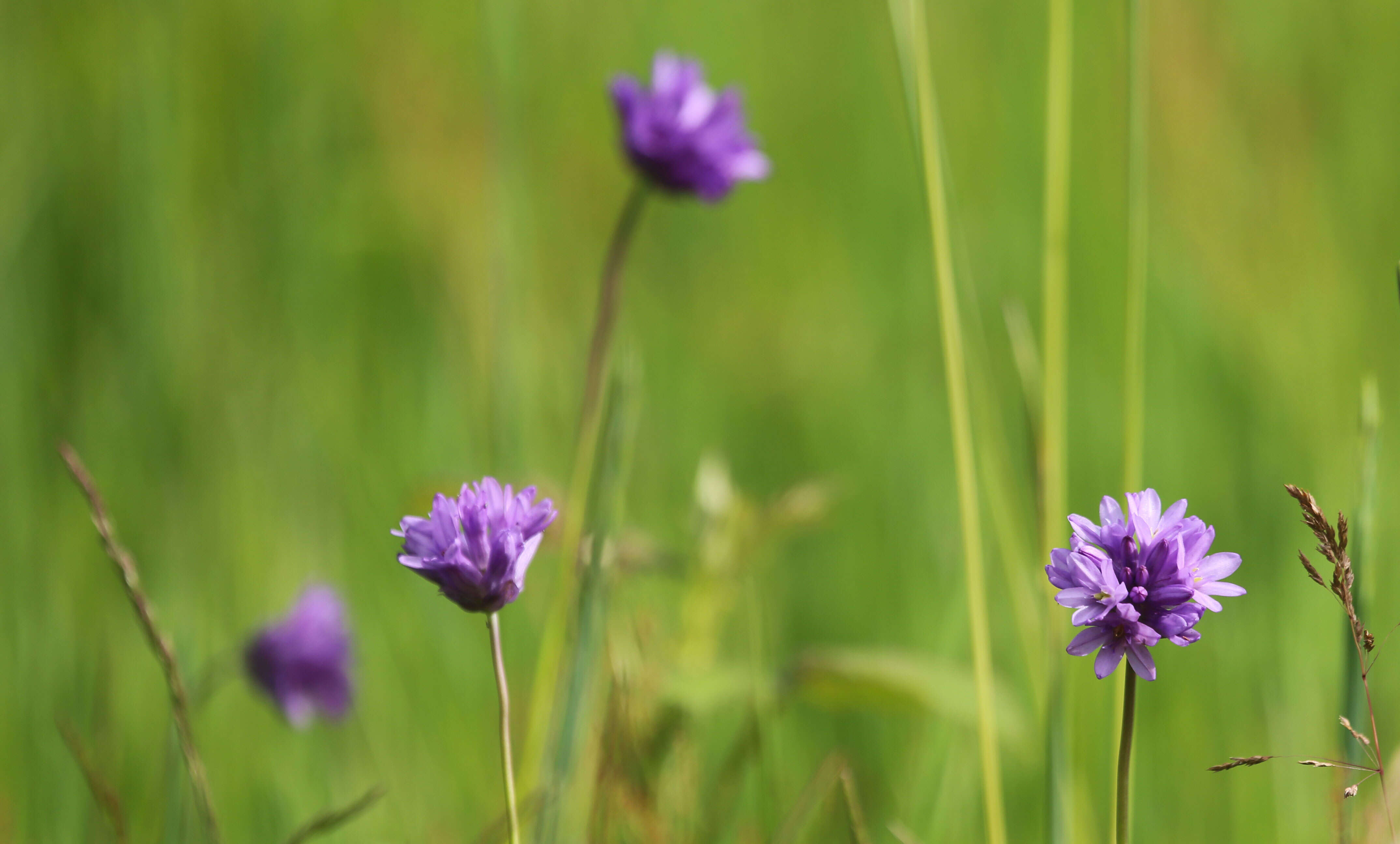
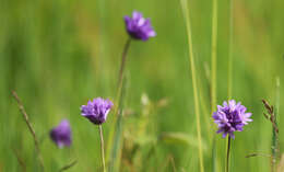
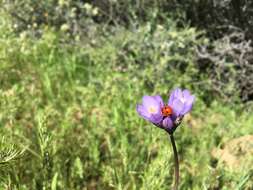
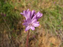
Description: Wildflowers galore on the new East Applegate Trail in southwest Oregon, May 7, 2018. Photos: Maria Thi Mai, BLM The new trail system opened in 2017 and includes 5.6 miles available for hiking, biking, and horse riding. Visitors can experience five different ecoregions—oak, woodland, pine, chapparal, mixed woodland and meadow—while soaking up the views of surrounding public land, like Wood Rat Mountain and the Poorman and Bishop Creek drainages. There are 40-50 different wildflowers living in the area. Plants included in these photos: young poison oak; popcorn flowers; California poppy; lupine; sea blush; and fork-toothed ookow. Directions: From Jacksonville Oregon, go west on Applegate St, becoming Cady Road for 1.9 miles. Turn south on Sterling Creek Road. Go approximately 4 miles, turning west on BLM Road 38-2-29.1. The trail head is approximately 1/4 of a mile at the end of the road. Contact the BLM office in Medford for questions: 541-618-2200 or BLM_OR_MD_Mail@blm.gov. Date: 7 May 2018, 11:13. Source: Fork-toothed ookow on the East Applegate Trail. Author: Bureau of Land Management Oregon and Washington from Portland, America. Camera location42° 15′ 27″ N, 122° 59′ 37.59″ WView all coordinates using: OpenStreetMap 42.257500; -122.993775.
Description: Wildflowers galore on the new East Applegate Trail in southwest Oregon, May 7, 2018. Photos: Maria Thi Mai, BLM The new trail system opened in 2017 and includes 5.6 miles available for hiking, biking, and horse riding. Visitors can experience five different ecoregions—oak, woodland, pine, chapparal, mixed woodland and meadow—while soaking up the views of surrounding public land, like Wood Rat Mountain and the Poorman and Bishop Creek drainages. There are 40-50 different wildflowers living in the area. Plants included in these photos: young poison oak; popcorn flowers; California poppy; lupine; sea blush; and fork-toothed ookow. Directions: From Jacksonville Oregon, go west on Applegate St, becoming Cady Road for 1.9 miles. Turn south on Sterling Creek Road. Go approximately 4 miles, turning west on BLM Road 38-2-29.1. The trail head is approximately 1/4 of a mile at the end of the road. Contact the BLM office in Medford for questions: 541-618-2200 or BLM_OR_MD_Mail@blm.gov. Date: 7 May 2018, 10:30. Source: Fork-toothed ookow on the East Applegate Trail. Author: Bureau of Land Management Oregon and Washington from Portland, America. Camera location42° 14′ 59.77″ N, 122° 59′ 15.42″ WView all coordinates using: OpenStreetMap 42.249936; -122.987617.
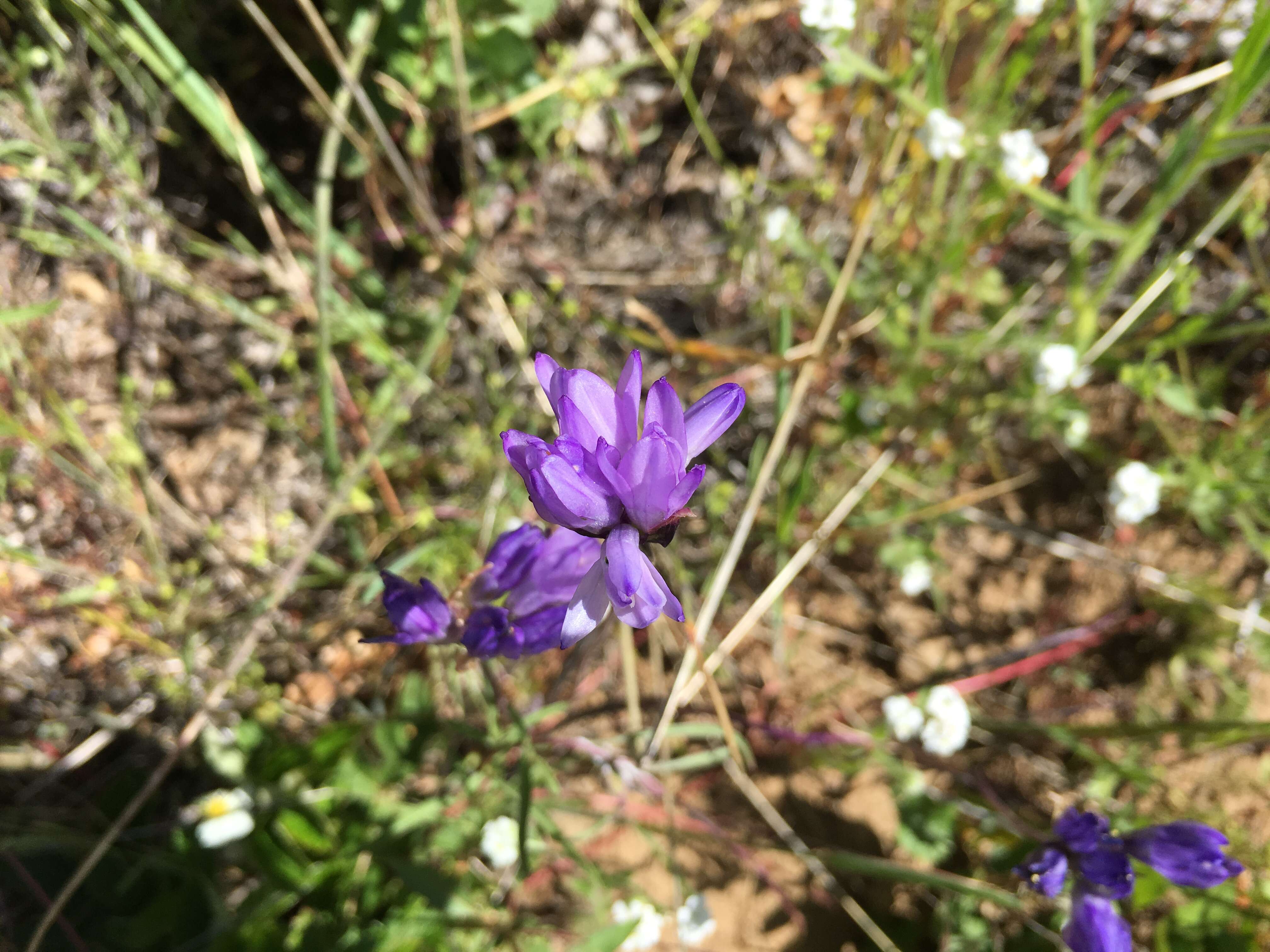
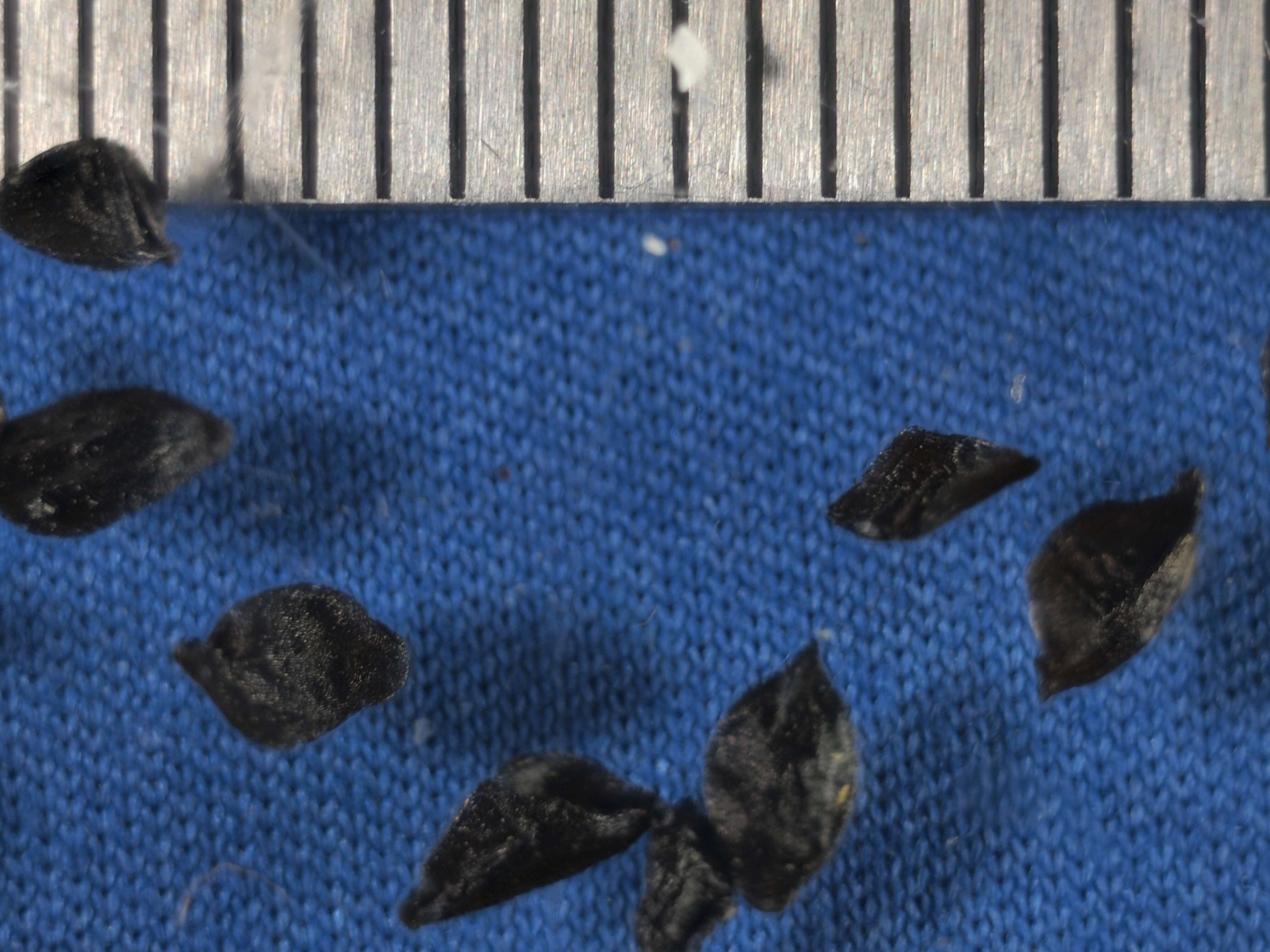
Description: Dichelostemma congestum. Date: 27 April 2007. Source: Xerantheum uploaded originally to en.wikipedia on 4 October 2007. Author: Xerantheum. Permission (Reusing this file): I, the copyright holder of this work, hereby publish it under the following licenses: : Permission is granted to copy, distribute and/or modify this document under the terms of the GNU Free Documentation License, Version 1.2 or any later version published by the Free Software Foundation; with no Invariant Sections, no Front-Cover Texts, and no Back-Cover Texts. A copy of the license is included in the section entitled GNU Free Documentation License.http://www.gnu.org/copyleft/fdl.htmlGFDLGNU Free Documentation Licensetruetrue. : This file is licensed under the Creative CommonsAttribution-Share Alike 3.0 Unported license.:.. This licensing tag was added to this file as part of the GFDL licensing update.http://creativecommons.org/licenses/by-sa/3.0/CC-BY-SA-3.0Creative Commons Attribution-Share Alike 3.0truetrue. You may select the license of your choice..
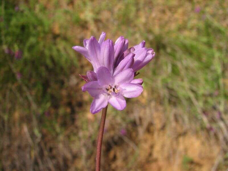
Description: Français : Inflorescence de Dichelostemma congestum - Jardin des Plantes de Paris English: Inflorescence of Dichelostemma congestum - Ookow or forked-toothed ookow - Jardin des Plantes de Paris. Date: 18 May 2015, 15:38:05. Source: Own work. Author: Dinkum. Camera location48° 50′ 36.92″ N, 2° 21′ 33.16″ EView all coordinates using: OpenStreetMap 48.843590; 2.359212.