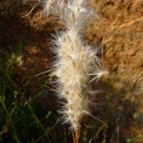
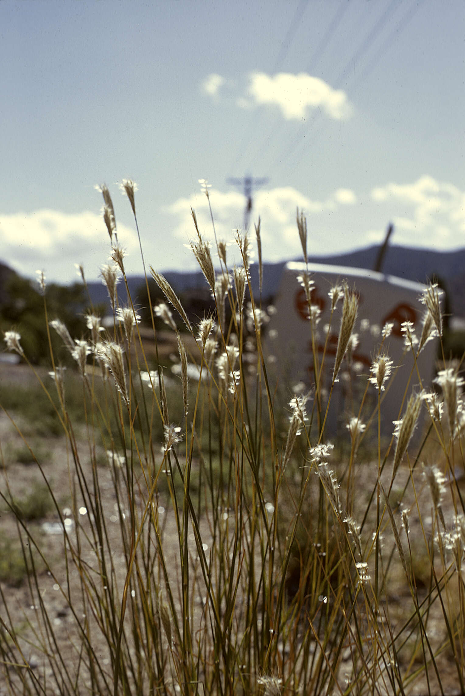
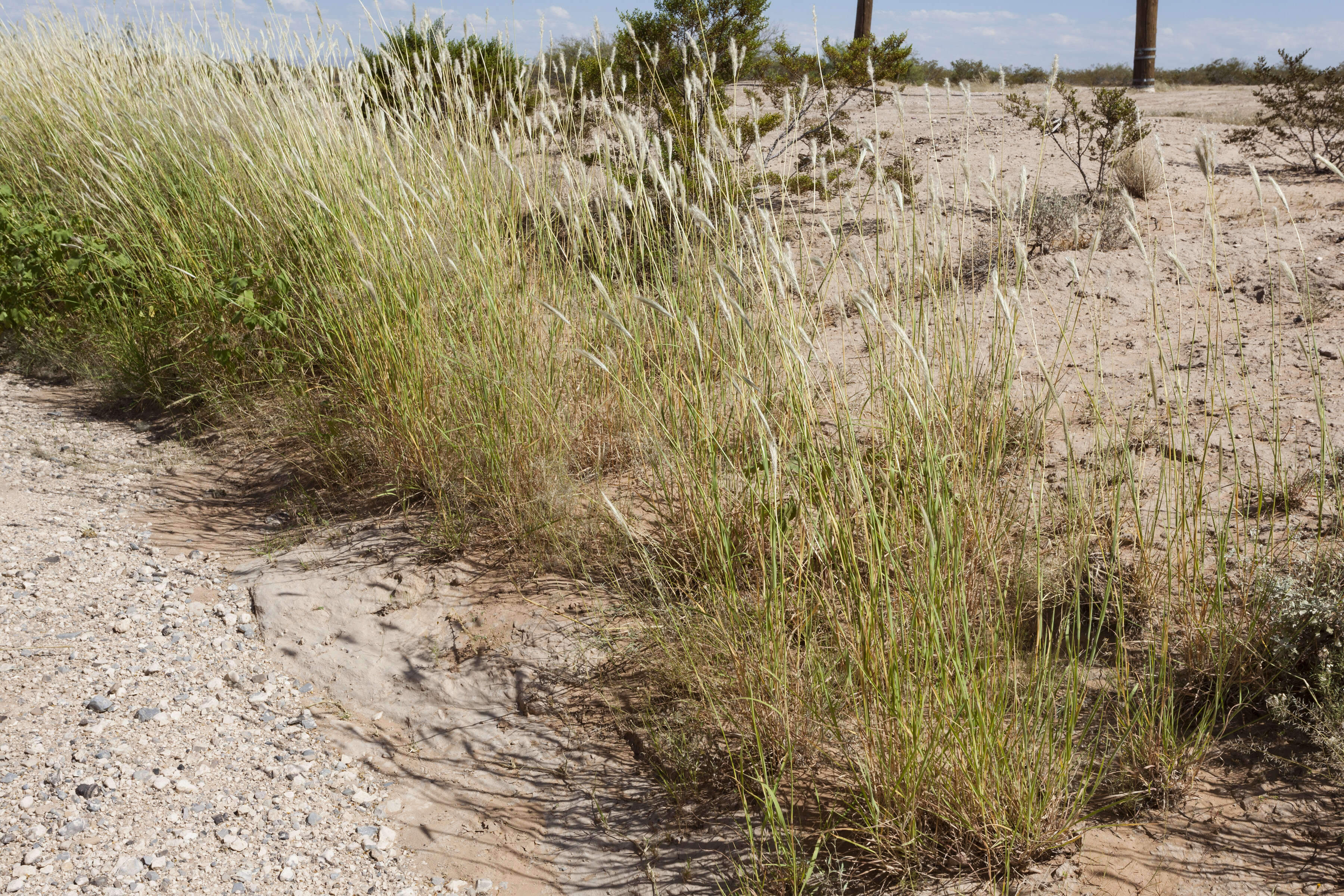
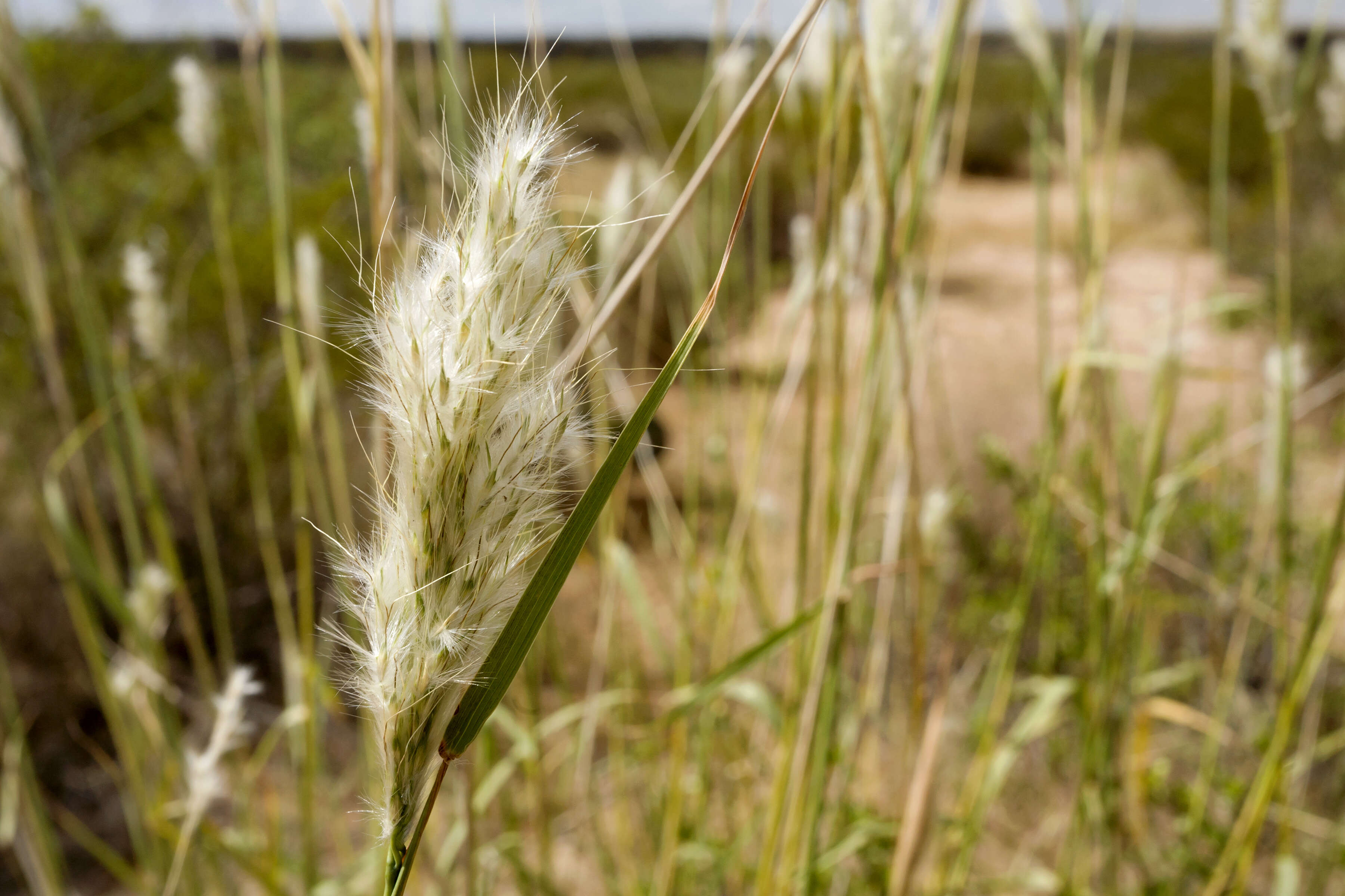
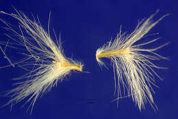
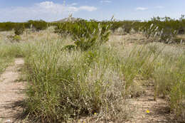
Description: Bothriochloa barbinodis, between the North Franklin Mountains and Chaparral, east-southeast of North Anthony’s Nose and east-northeast of Anthony Gap, 32.0331 -106.4887, Doña Ana County, New Mexico, 22 Sep 2017. Date: 22 September 2017, 13:28. Source: Bothriochloa barbinodis. Author: Patrick Alexander from Las Cruces, NM. Camera location32° 01′ 59.16″ N, 106° 29′ 19.32″ WView all coordinates using: OpenStreetMap 32.033100; -106.488700.
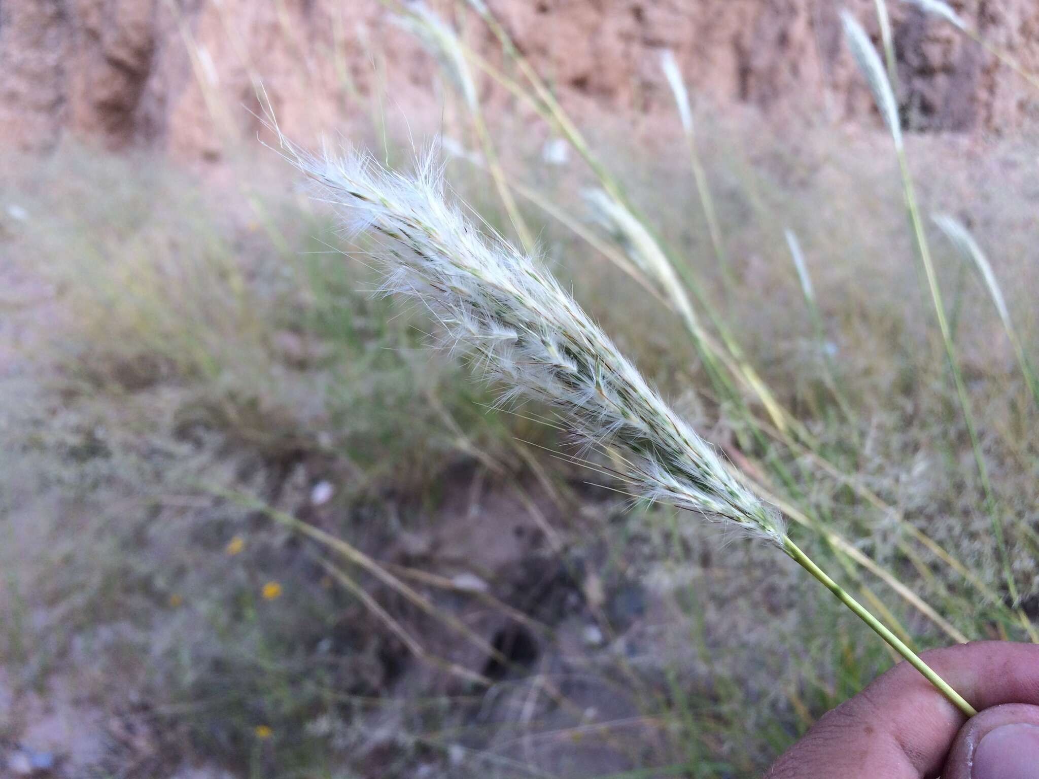
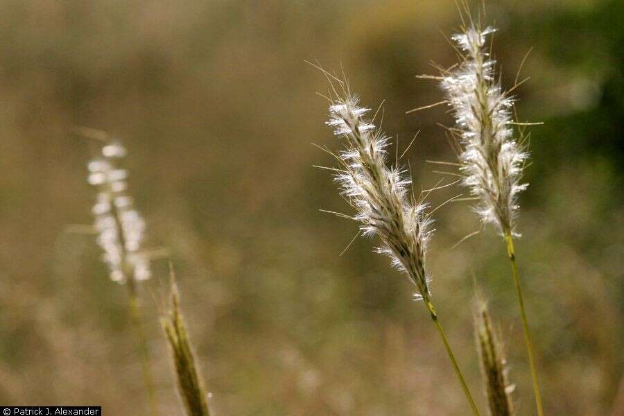
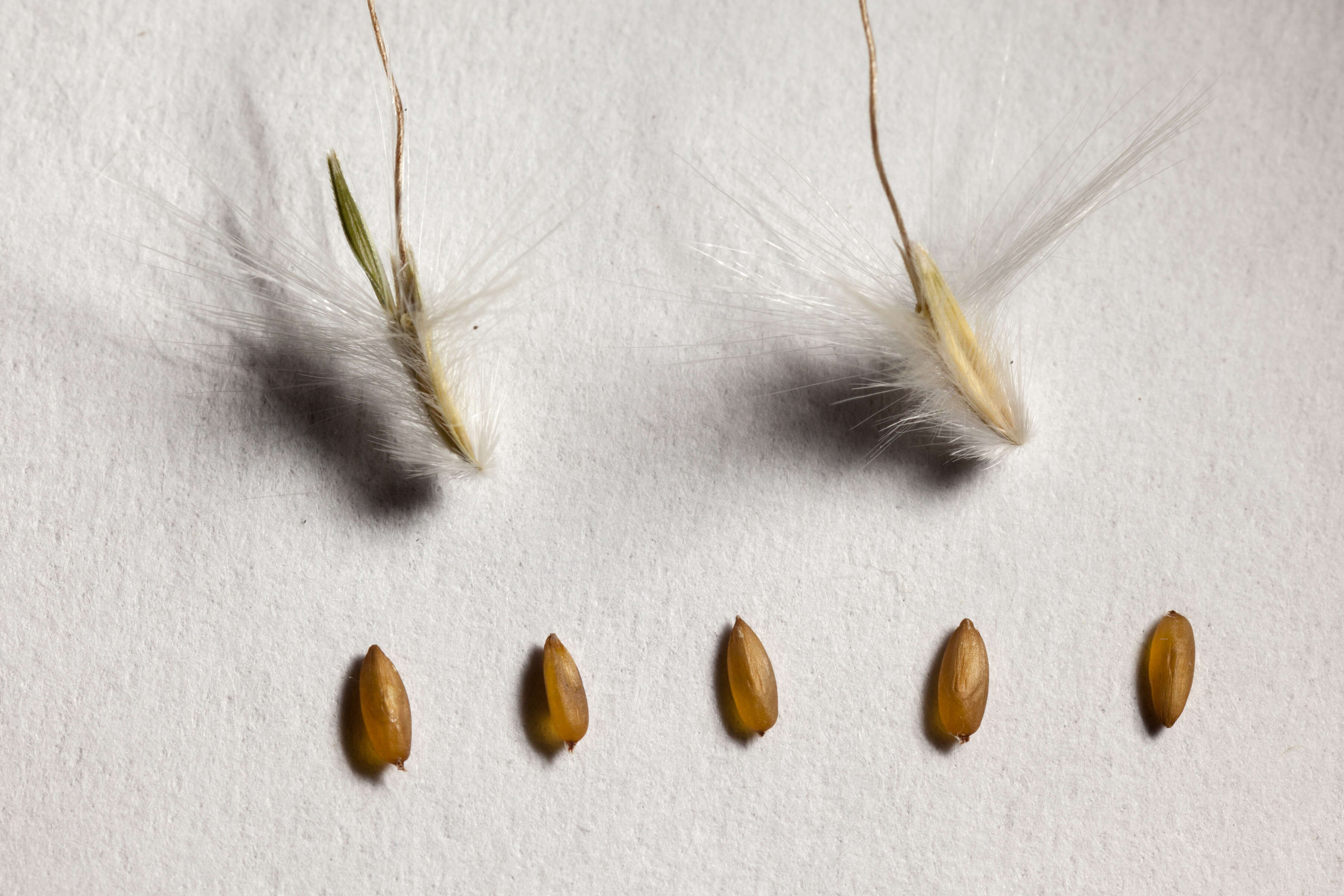
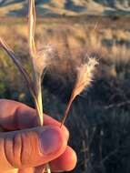
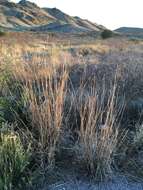
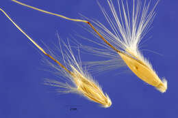
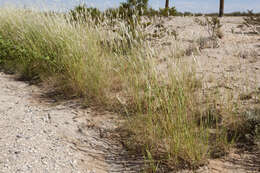
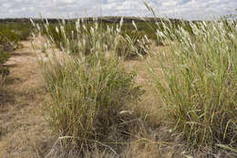
Description: Bothriochloa barbinodis, northeastern Playas Valley, west-northwest of the Brockman Hills, south of Pride Hill, 32.0863 -108.5712, Hidalgo County, New Mexico, 20 Aug 2015. Date: 20 August 2015, 12:18. Source: Bothriochloa barbinodis. Author: Patrick Alexander from Las Cruces, NM. Camera location32° 05′ 10.68″ N, 108° 34′ 16.32″ WView all coordinates using: OpenStreetMap 32.086300; -108.571200.
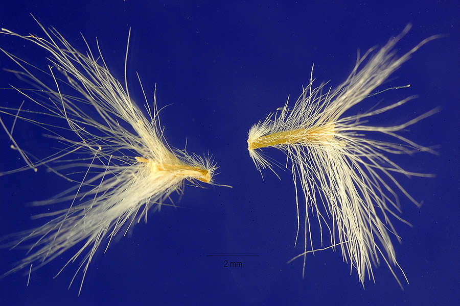
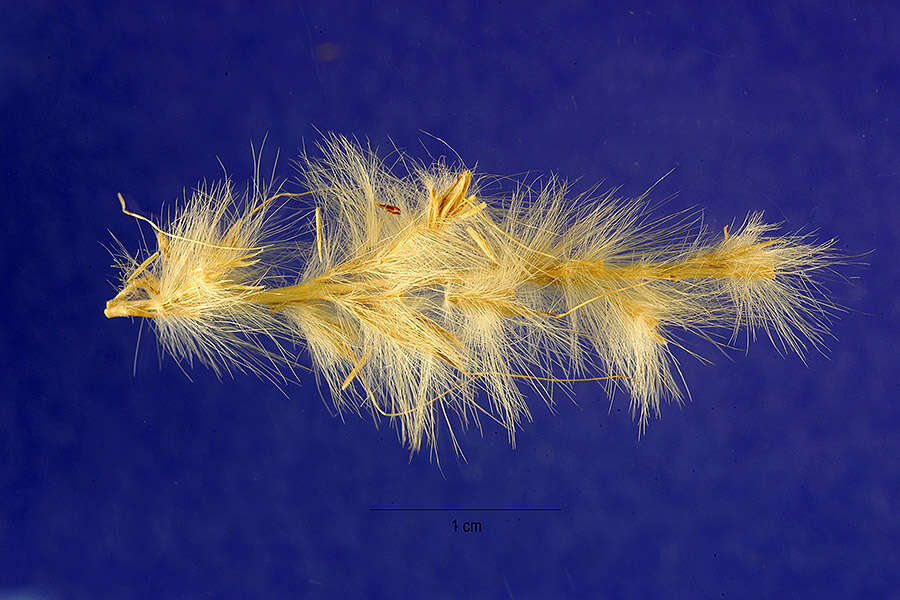
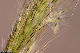
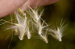
Description: Bothriochloa barbinodis, collected between the North Franklin Mountains and Chaparral, east-southeast of North Anthony’s Nose and east-northeast of Anthony Gap, 32.033 -106.489, Doña Ana County, New Mexico, 22 Sep 2017. Date: 24 October 2017, 13:45. Source: Bothriochloa barbinodis. Author: Patrick Alexander from Las Cruces, NM. Camera location32° 01′ 58.8″ N, 106° 29′ 20.4″ WView all coordinates using: OpenStreetMap 32.033000; -106.489000.
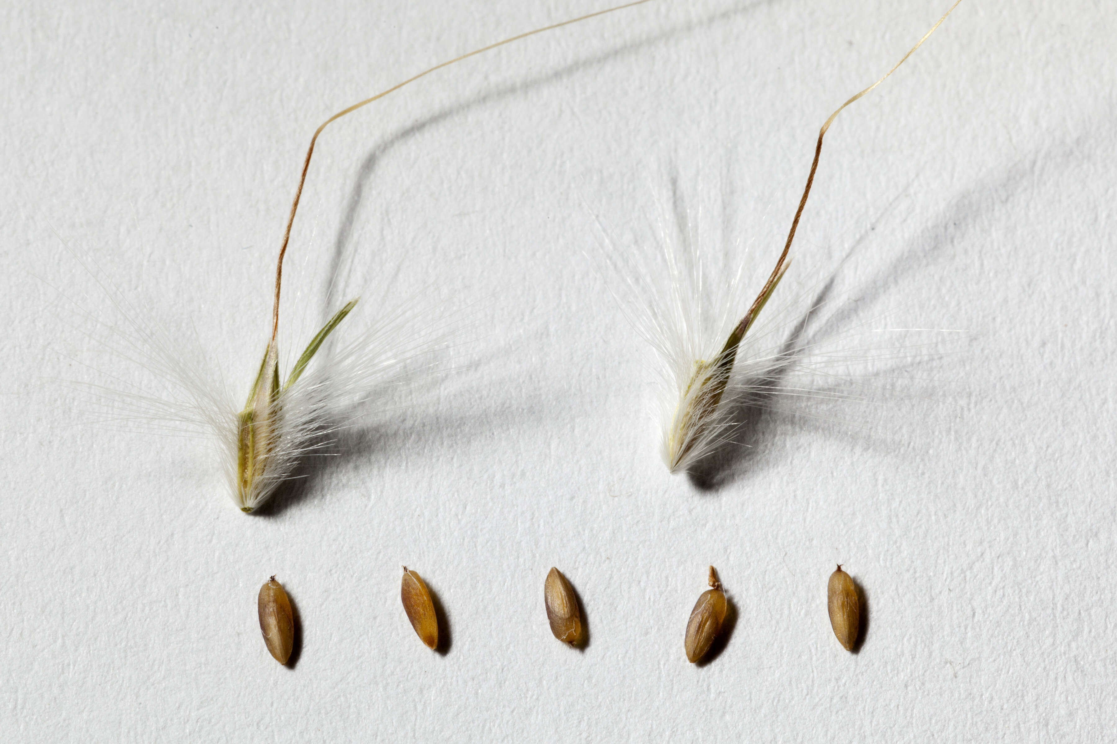
Description: Bothriochloa barbinodis, northeastern Playas Valley, west-northwest of the Brockman Hills, south of Pride Hill, 32.0863 -108.5712, Hidalgo County, New Mexico, 20 Aug 2015. Date: 20 August 2015, 12:24. Source: Bothriochloa barbinodis. Author: Patrick Alexander from Las Cruces, NM. Camera location32° 05′ 10.68″ N, 108° 34′ 16.32″ WView all coordinates using: OpenStreetMap 32.086300; -108.571200.
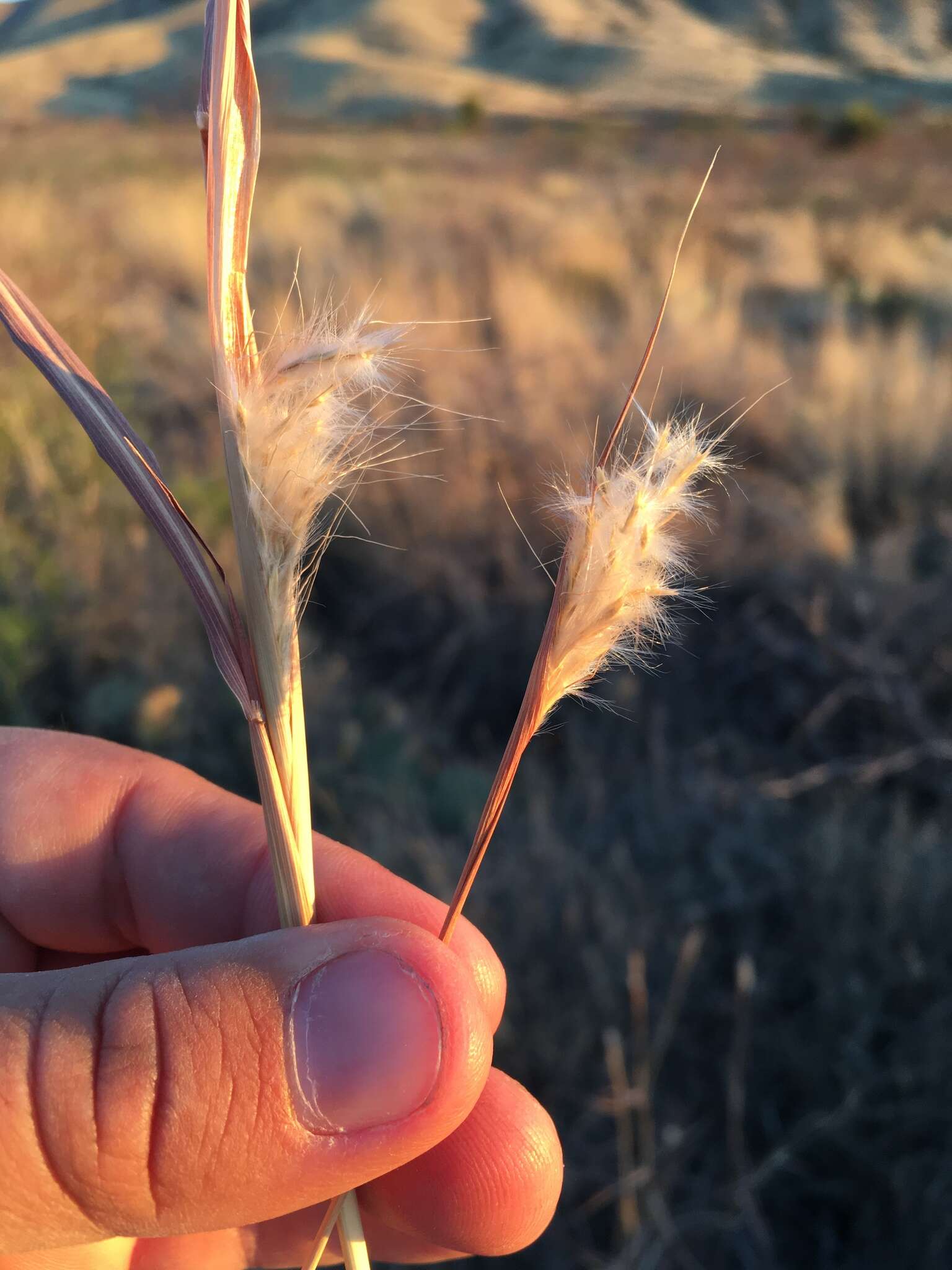
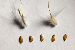
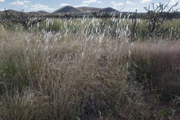
Description: Bothriochloa barbinodis, collected in the West Potrillo Mountains, east of Potrillo Peak and west of Cox Peak, 31.9241 -107.1988, Doña Ana County, New Mexico, photographed 18 Oct 2018. Date: 18 October 2018, 14:43. Source: Bothriochlo barbinodis. Author: Patrick Alexander from Las Cruces, NM. Camera location31° 55′ 26.76″ N, 107° 11′ 55.68″ WView all coordinates using: OpenStreetMap 31.924100; -107.198800.
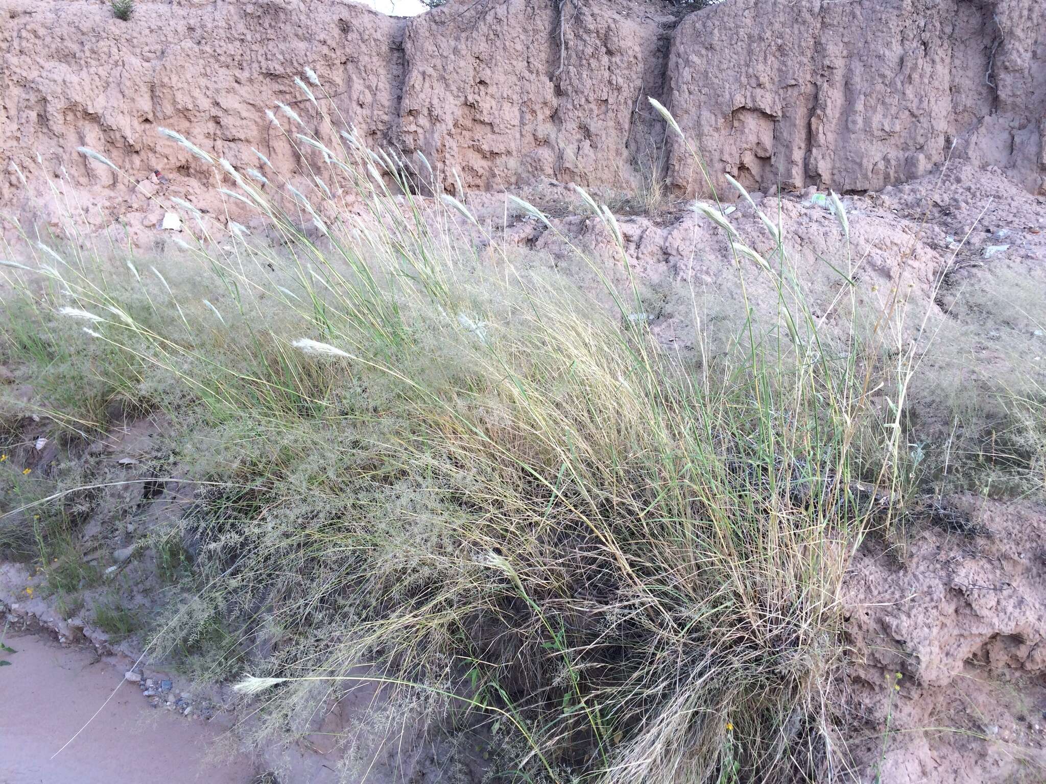
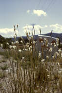
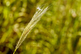
Description: Bothriochloa barbinodis, collected near the north edge of the Aden Malpais west of Afton, 32.07864 -106.98192, Doña Ana County, New Mexico, 30 Sep 2015. Date: 30 September 2015, 11:58. Source: Bothriochloa barbinodis. Author: Patrick Alexander from Las Cruces, NM. Camera location32° 04′ 43.1″ N, 106° 58′ 54.91″ WView all coordinates using: OpenStreetMap 32.078640; -106.981920.
Description: Bothriochloa barbinodis near the northeast edge of Aden Malpais, west-northwest of Afton, 32.079 -106.982, Doña Ana County, New Mexico, 25 Sep 2015. Date: 25 September 2015, 15:46. Source: Bothriochloa barbinodis. Author: Patrick Alexander from Las Cruces, NM. Camera location32° 04′ 44.4″ N, 106° 58′ 55.2″ WView all coordinates using: OpenStreetMap 32.079000; -106.982000.
Description: Bothriochloa barbinodis, northeastern Playas Valley, west-northwest of the Brockman Hills, south of Pride Hill, 32.0863 -108.5712, Hidalgo County, New Mexico, 20 Aug 2015. Date: 20 August 2015, 12:21. Source: Bothriochloa barbinodis. Author: Patrick Alexander from Las Cruces, NM. Camera location32° 05′ 10.68″ N, 108° 34′ 16.32″ WView all coordinates using: OpenStreetMap 32.086300; -108.571200.
Description: Bothriochloa barbinodis near the northeast edge of Aden Malpais, west-northwest of Afton, 32.079 -106.982, Doña Ana County, New Mexico, 25 Sep 2015. Date: 25 September 2015, 15:44. Source: Bothriochloa barbinodis. Author: Patrick Alexander from Las Cruces, NM. Camera location32° 04′ 44.4″ N, 106° 58′ 55.2″ WView all coordinates using: OpenStreetMap 32.079000; -106.982000.
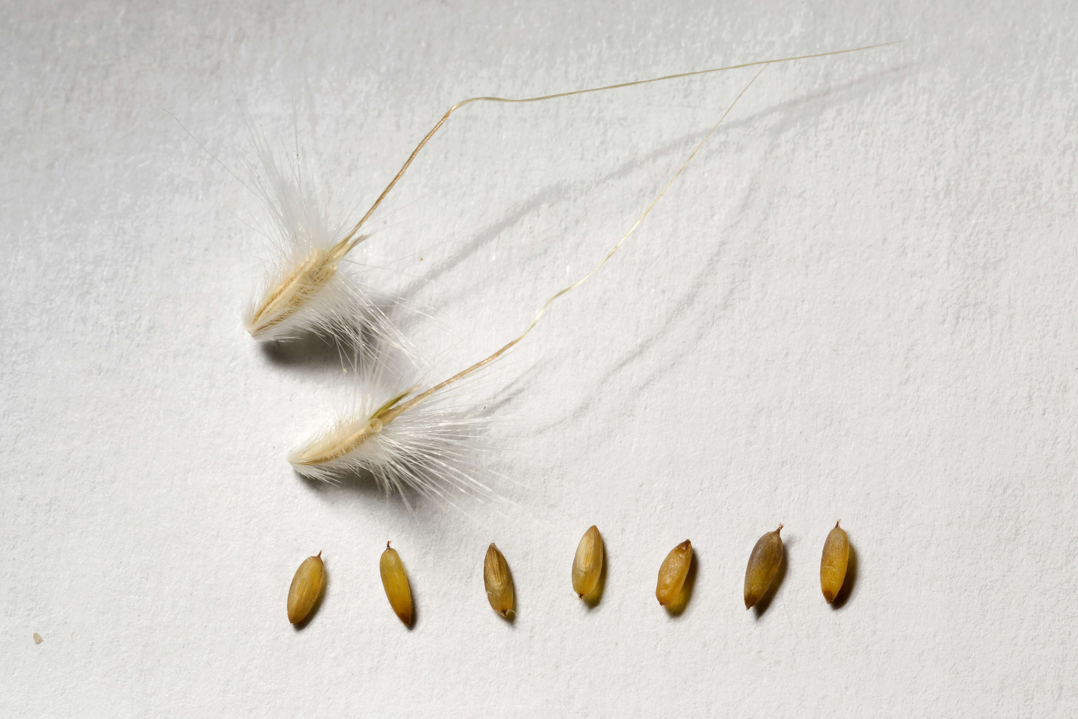
Description: Bothriochloa barbinodis, West Potrillo Mountains, east of Potrillo Peak and west of Cox Peak, 31.9241 -107.1988, Doña Ana County, New Mexico, 22 Sep 2018. Date: 22 September 2018, 14:41. Source: Bothriochloa barbinodis. Author: Patrick Alexander from Las Cruces, NM. Camera location31° 55′ 26.76″ N, 107° 11′ 55.68″ WView all coordinates using: OpenStreetMap 31.924100; -107.198800.