Shell
描述:
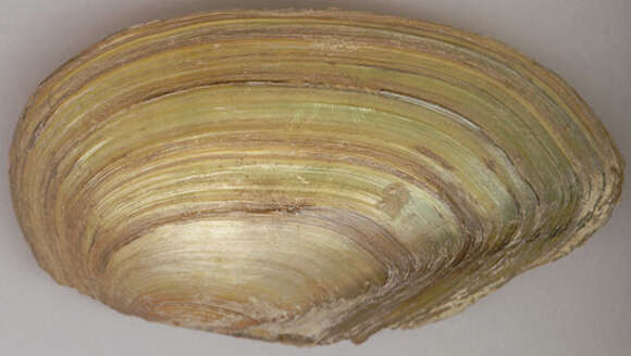
Longitude (deg): -1.7. Latitude (deg): 51.5. Longitude (deg/min): 1° 40' W. Latitude (deg/min): 51° 30' N. Vice county name: North Wilts. Vice county no.: 7. Country: England. Stage: Dead shell. Identified by: Dr. Karl-Otto Nagel. Comment: Dead shells found stranded on mud when water drawn down for maintenance. Category: macro-photograph. Real world width(mm): 92.456. Photographic equipment used: Specimens directly scanned on Black Widow 9630 SP flatbed scanner.
來源資訊
- 許可
- cc-by-nc-sa-3.0
- 版權
- Malcolm Storey
- 攝影者
- Malcolm Storey
- 編纂者
- Malcolm Storey
- 原始內容
- 原始媒體檔案
- 參訪來源
- 合作夥伴網站
- BioImages, the virtual fieldguide, UK
- ID