-
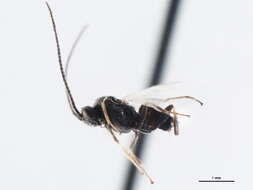
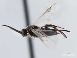
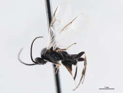
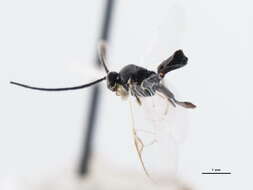
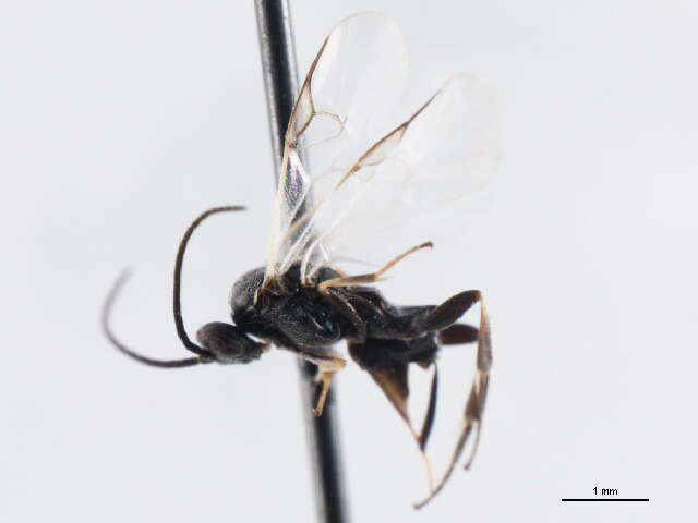
Lateral..
-
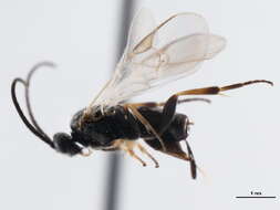
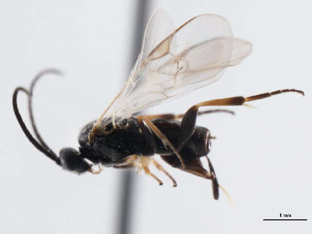
Lateral..
-
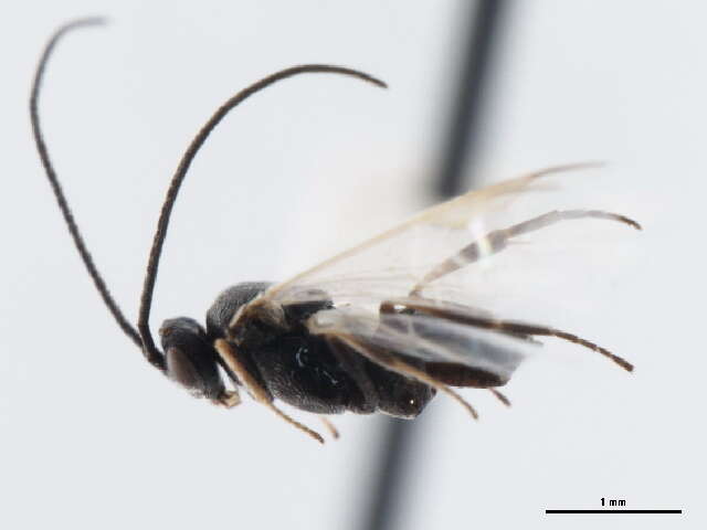
Lateral..
-
Lateral..
-
Lateral..
-
Lateral..
-
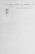
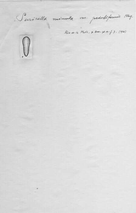
Original nib drawing made by Frenguelli.
-
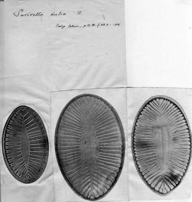
Original nib drawing made by Frenguelli.
-
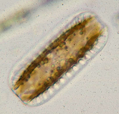
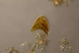
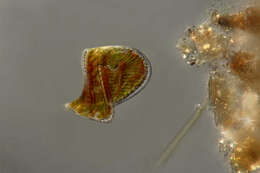
Longitude (deg): -0.7. Latitude (deg): 51.0. Longitude (deg/min): 0° 40' W. Latitude (deg/min): 51° 0' N. Vice county name: West Sussex. Vice county no.: 13. Country: England. Identified by: Malcolm Storey. Comment: in sample from pond. Category: microscope photograph. Image scaling: magnified. Photographic equipment used: "35mm transparencies (on a variety of films, but Agfa CT18 in the 1960's to early 1980's followed by Fujichrome in the late 1980's.) Transparencies scanned with Minolta Dimage Scan Dual II AF-2820U transparency scanner.".
-
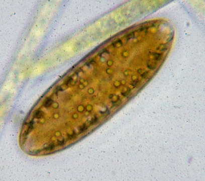
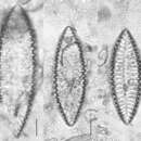
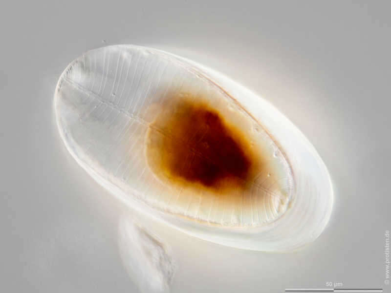
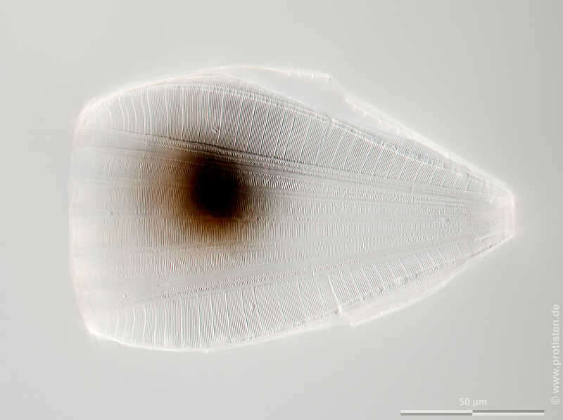
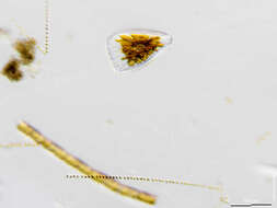
Surirella elegans Scale bar indicates 50 µm. The specimen was gathered in the Kieler Förde (Baltic Sea). Sampling date 1/2022. The image was built up using several photomicrographic frames with manual stacking technique. Images were taken using Zeiss Axioplan with Olympus OM-D M5 MKII. Image under Creative Commons License V 3.0 (CC BY-NC-SA). Place name: Baltic Sea, Kieler Förde, Kiel Fjord (Germany) Latitude: 54.3894126 Longitude: 10.1749055 Multiebenen-Abbildung, manuell gestapelt. Der Messbalken markiert eine Länge von 50 µm. Probe aus der Kieler Förde. Datum der Aufsammlung: 1/2022. Mikrotechnik: Zeiss Axioplan, Kamera: Olympus OM-D M5 MKII. Creative Commons License V 3.0 (CC BY-NC-SA). For permission to use of (high-resolution) images please contact postmaster@protisten.de.
-
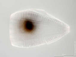
Surirella elegans Scale bar indicates 100 µm. The specimen was gathered in the Kieler Förde (Baltic Sea). Sampling date 1/2022. The image was built up using several photomicrographic frames with manual stacking technique. Images were taken using Olympus stereo microscope SZX16/Planapo 2.0x with Olympus OM-D M5 MKII. Image under Creative Commons License V 3.0 (CC BY-NC-SA). Place name: Baltic Sea, Kieler Förde, Kiel Fjord (Germany) Latitude: 54.3894126 Longitude: 10.1749055 Multiebenen-Abbildung, manuell gestapelt. Der Messbalken markiert eine Länge von 100 µm. Probe aus der Kieler Förde. Datum der Aufsammlung: 1/2022. Mikrotechnik: Olympus stereo microscope SZX16/Planapo 2.0x, Kamera: Olympus OM-D M5 MKII. Creative Commons License V 3.0 (CC BY-NC-SA). For permission to use of (high-resolution) images please contact postmaster@protisten.de.
-
Surirella elegans Scale bar indicates 50 µm. The specimen was gathered in the Kieler Förde (Baltic Sea). Sampling date 1/2022. The image was built up using several photomicrographic frames with manual stacking technique. Images were taken using Zeiss Axioplan with Olympus OM-D M5 MKII. Image under Creative Commons License V 3.0 (CC BY-NC-SA). Place name: Baltic Sea, Kieler Förde, Kiel Fjord (Germany) Latitude: 54.3894126 Longitude: 10.1749055 Multiebenen-Abbildung, manuell gestapelt. Der Messbalken markiert eine Länge von 50 µm. Probe aus der Kieler Förde. Datum der Aufsammlung: 1/2022. Mikrotechnik: Zeiss Axioplan, Kamera: Olympus OM-D M5 MKII. Creative Commons License V 3.0 (CC BY-NC-SA). For permission to use of (high-resolution) images please contact postmaster@protisten.de.
-
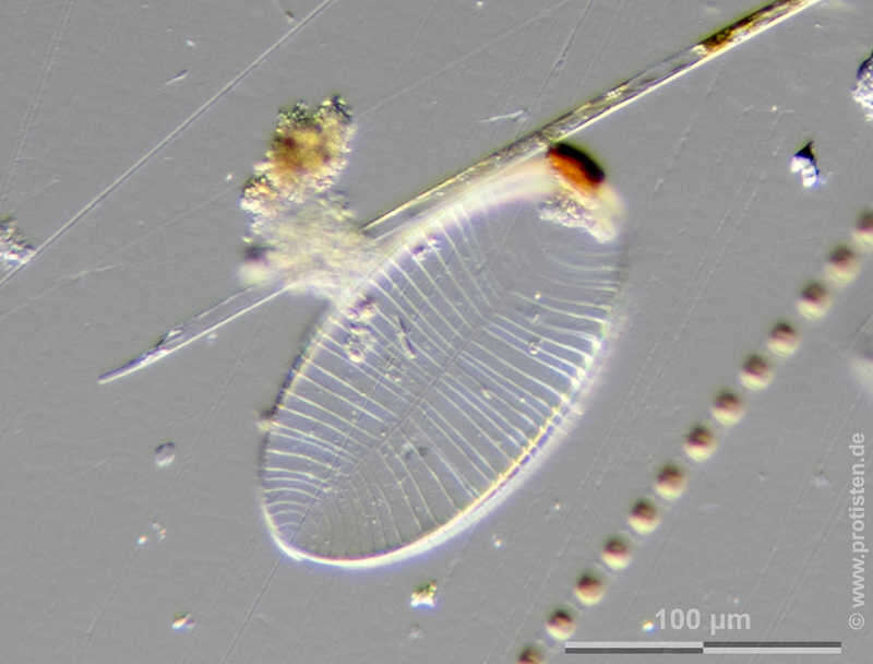
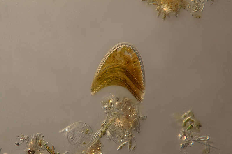
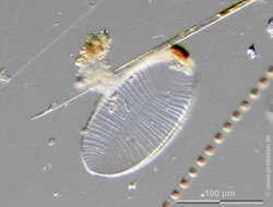
Surirella linearis Cingular view displayin 3 of the 4 raphe keels. Scale bar indicates 50 µm. Sample from a wetland at the Pillersee (Tyrol, Austria). The image was built up using several photomicrographic frames with manual stacking technique. Images were taken using Zeiss Universal with Olympus C7070 CCD camera.Image under Creative Commons License V 3.0 (CC BY-NC-SA). Place name: Wetland at the Pillersee (Tyrol, Austria) Latitude: 47.531785 Longitude: 12.573095 Gürtelbandansicht mit 3 der 4 Flügeln (robustae) mit den Raphenkanälen. Multiebenen-Abbildung, manuell gestapelt. Der Messbalken markiert eine Länge von 50 µm. Probe aus dem Pillersee in Tirol. Mikrotechnik: Zeiss Universal, Kamera: Olympus C7070. Creative Commons License V 3.0 (CC BY-NC-SA). For permission to use of (high-resolution) images please contact postmaster@protisten.de.
-
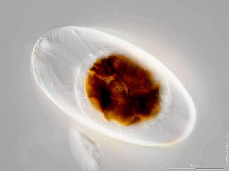
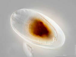
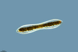
Campylodiscus spec. The specimen was gathered in ponds near Hausen (Hessisch Lichtenau , Germany). Copyright Winfried Hölz, Hausen, Germany.Images were taken using Zeiss Axioskop with DSLR.Image under Creative Commons License V 3.0 (CC BY-NC-SA). Place name: Ponds near Hausen (Hessisch Lichtenau , Germany) Latitude: 51.21453 Longitude: 9.868894 Probe aus Gewässern nahe Hausen (Hessisch Lichtenau).Copyright Winfried Hölz, Hausen. Mikrotechnik: Zeiss Axioskop, Kamera: DSLR. Creative Commons License V 3.0 (CC BY-NC-SA). For permission to use of (high-resolution) images please contact postmaster@protisten.de.
-
Fuente de Piedra, Andalusia, Spain
-
Miranda do Douro Municipality, Braganca, Portugal
-
Miranda do Douro Municipality, Braganca, Portugal
-
Miranda do Douro, Bragana, Portugal
-
Miranda do Douro, Bragana, Portugal
-
Miranda do Douro, Bragana, Portugal