03176jfSan Isidro, Nueva Ecija River Roads Riverfvf 26
Description:
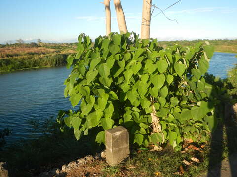
Description: English: Nueva Ecija River banks, Nueva Ecija River Districts (Pampanga River basin) from the Philippine highway network N3 highway, Poblacion, Alua, Santo Cristo and San Roque (Gapan-Olongapo Road, San Isidro, Nueva Ecija) N3 José Abad Santos Avenue (Olongapo-Gapan Road / Gapan-San Fernando-Olongapo Road) 15°2'20"N 120°40'49"E Barangays Calaba 15°17'54"N 120°52'17"E from Poblacion 15°18'31"N 120°54'26"E Alua 15°18'28"N 120°53'44"E San Roque and Santo Cristo 15°18'1"N San Isidro, Nueva Ecija (Note: Judge Florentino Floro, the owner, to repeat, Donor Florentino Floro of all these photos hereby donate gratuitously, freely and unconditionally all these photos to and for Wikimedia Commons, exclusively, for public use of the public domain, and again without any condition whatsoever). Date: 8 May 2017, 17:12:43. Source: Own work. Author: Judgefloro. Camera location15° 17′ 54″ N, 120° 52′ 17″ E View all coordinates using: OpenStreetMap - Google Earth. Calaba 15°17'54"N 120°52'17"E Licensing[edit] : This file is made available under the Creative Commons CC0 1.0 Universal Public Domain Dedication. The person who associated a work with this deed has dedicated the work to the public domain by waiving all of his or her rights to the work worldwide under copyright law, including all related and neighboring rights, to the extent allowed by law. You can copy, modify, distribute and perform the work, even for commercial purposes, all without asking permission. http://creativecommons.org/publicdomain/zero/1.0/deed.enCC0Creative Commons Zero, Public Domain Dedicationfalsefalse.
Included On The Following Pages:
- Life (creatures)
- Cellular (cellular organisms)
- Eukaryota (eukaryotes)
- Archaeplastida (plants)
- Chloroplastida (green plants)
- Streptophyta
- Embryophytes
- Tracheophyta (ferns)
- Spermatophytes (seed plants)
- Angiosperms (Dicotyledons)
- Eudicots
- Superasterids
- Asterids
- Lamiales ("An Order: Mints, Vervains, Snapdragons, Etc.")
- Lamiaceae (mint family)
- Gmelina
- Gmelina philippensis (wild sage)
This image is not featured in any collections.
Source Information
- license
- cc-publicdomain
- creator
- Judgefloro
- original
- original media file
- visit source
- partner site
- Wikimedia Commons
- ID