Diospyros texana range map

Kuvaus:
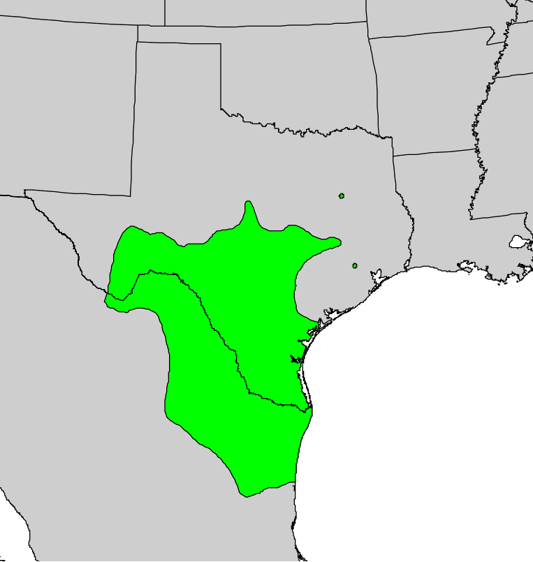
Description: English: Range map of Diospyros texana. Date: 1999. Source: Digital representation of "Atlas of United States Trees" by Elbert L. Little, Jr. [1]. Author: U.S. Geological Survey. All images in this article were uploaded in the JPEG format even though it consists of non-photographic data. This information could be stored more efficiently or accurately in the PNG or SVG format. If possible, please upload a PNG or SVG version of this image without compression artifacts, derived from a non-JPEG source (or with existing artifacts removed). After doing so, please tag the JPEG version with {{Superseded|NewImage.ext}} and remove this tag. This tag should not be applied to photographs or scans. For more information, see {{BadJPEG}}.
Mukana seuraavilla sivuilla:
- Life
- Cellular
- Eukaryota (aitotumaiset)
- Archaeplastida
- Chloroplastida
- Streptophyta
- Embryophytes
- Tracheophyta
- Spermatophytes (siemenkasvit)
- Angiosperms (kaksisirkkaiset)
- Eudicots
- Superasterids
- Asterids
- Ericales
- Ebenaceae (Eebenpuukasvit)
- Diospyros (Eebenpuut)
- Diospyros texana
Tämä kuva ei ole esillä missään kokoelmassa.
Lähdetiedot
- lisenssi
- cc-publicdomain
- luoja
- U.S. Geological Survey
- lähde
- Digital representation of "Atlas of United States Trees" by Elbert L. Little, Jr. [1]
- alkuperäinen
- alkuperäinen mediatiedosto
- käy lähteessä
- kumppanisivusto
- Wikimedia Commons
- ID