-
2005 The Regents of the University of California
CalPhotos
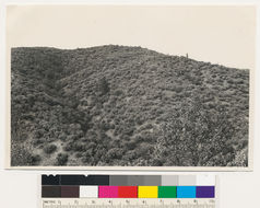
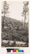
Wood-grass type 2 miles W of Igo. Digger pine- douglas fir, interior live oak, in woodland; grass chiefly Bromus hordeaceus; understory of Arctostaphylos viscida and Toxicodendrondiversilobum (=Rhus diversiloba), T 31 N R 6 W Sec 32 Quad name: Weaverville. Quad number: 24. Reference to map: 2.
-
2005 The Regents of the University of California
CalPhotos
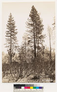
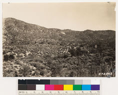
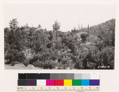
Ponderosa pine-black oak type on site 150 along road 1.5 miles E of Rainbow lake. Mature pine with Arctostaphylos viscida, Toxicodendrondiversilobum (=Rhus diversiloba), Ceanothus integerrimus in understory., T 31 N R 7 W Sec 32 Quad name: Weaverville. Quad number: 24. Reference to map: 5.
-
2005 The Regents of the University of California
CalPhotos
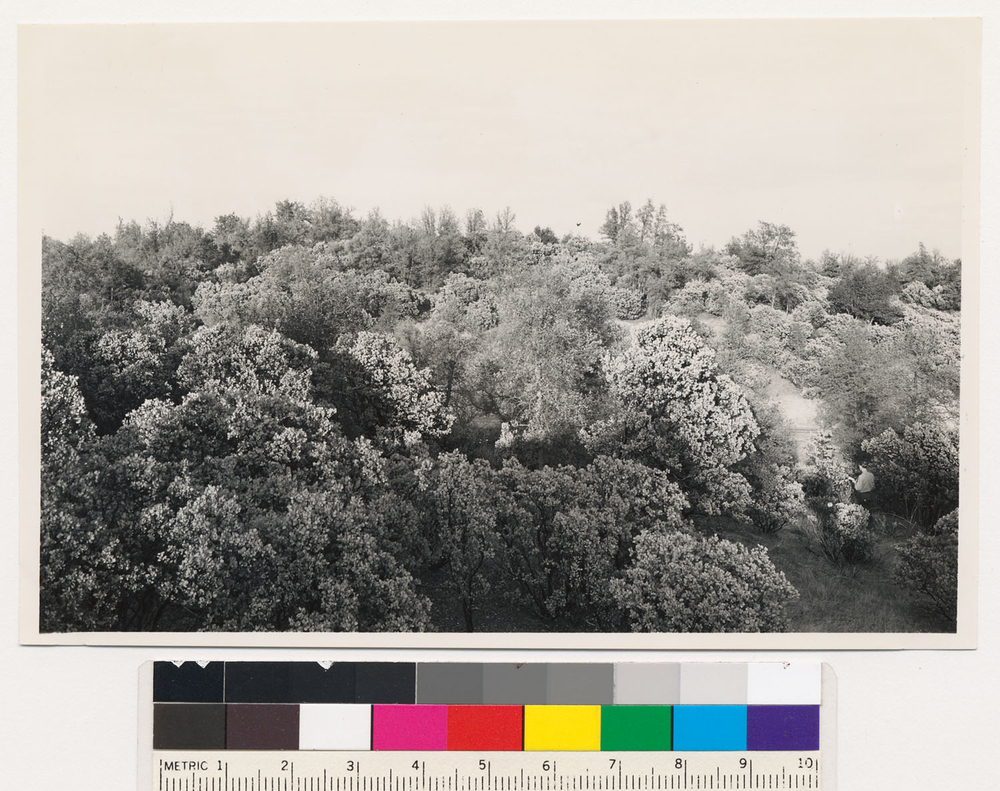
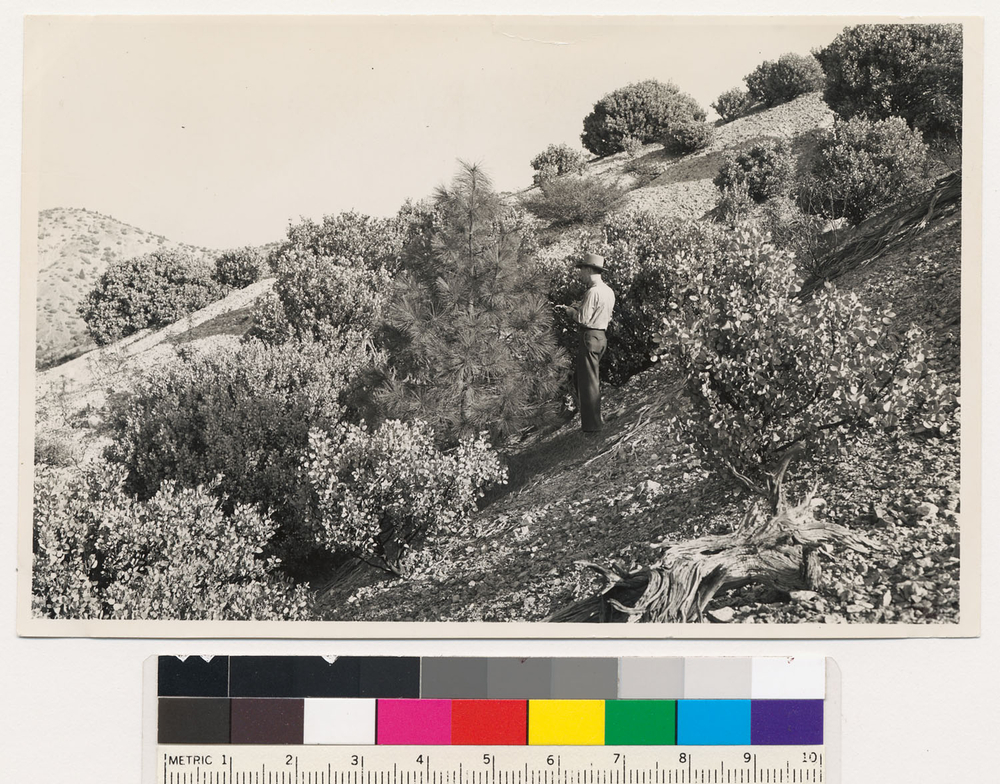
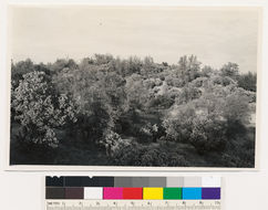
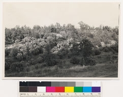
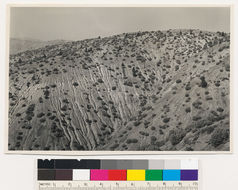
Woodland chaparral type with scattered ponderosa pine individuals. Tree at left is 19.3" DBH, 78' high and 74 years old, indicating a site index of 50+. Woodland trees of Digger pine, black oak, interior live oak and Douglas oak; chaparral of Arctostaphylos viscida, Ceanothus tomentosa, and Toxicodendrondiversilobum (=Rhus diversiloba)., T 32 N R 5 W Sec 10, Elevation 900 Quad name: Redding. Quad number: 23. Reference to map: 8.
-
2005 The Regents of the University of California
CalPhotos
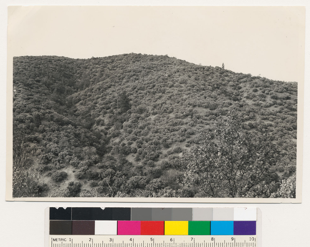
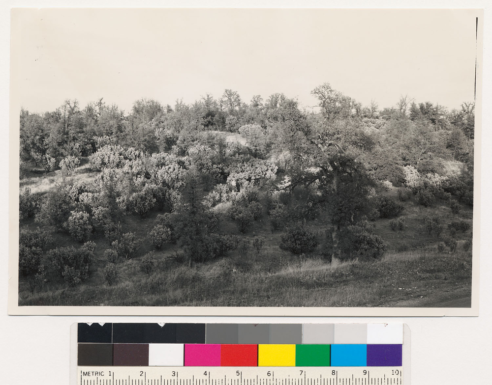
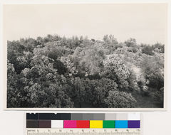
Typical woodland-chaparral type consisting of Douglas oak and Arctostaphylos viscida., T 32 N R 5 W Sec 14 Quad name: Redding. Quad number: 23. Reference to map: 7.
-
2005 The Regents of the University of California
CalPhotos
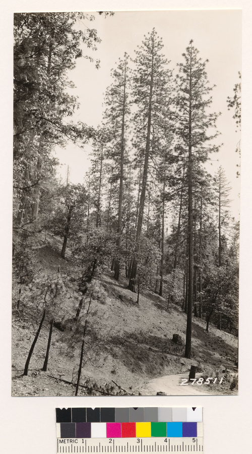
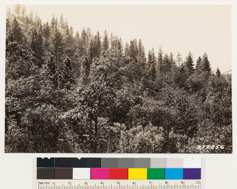
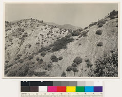
Looking S at N slope of scattered 2nd growth ponderosa pine. Other species black oak and Arctostaphylos viscida., T 32 N R 5 W Sec 2, Elevation 1000 Quad name: Redding. Quad number: 23. Reference to map: 18.
-
2005 The Regents of the University of California
CalPhotos
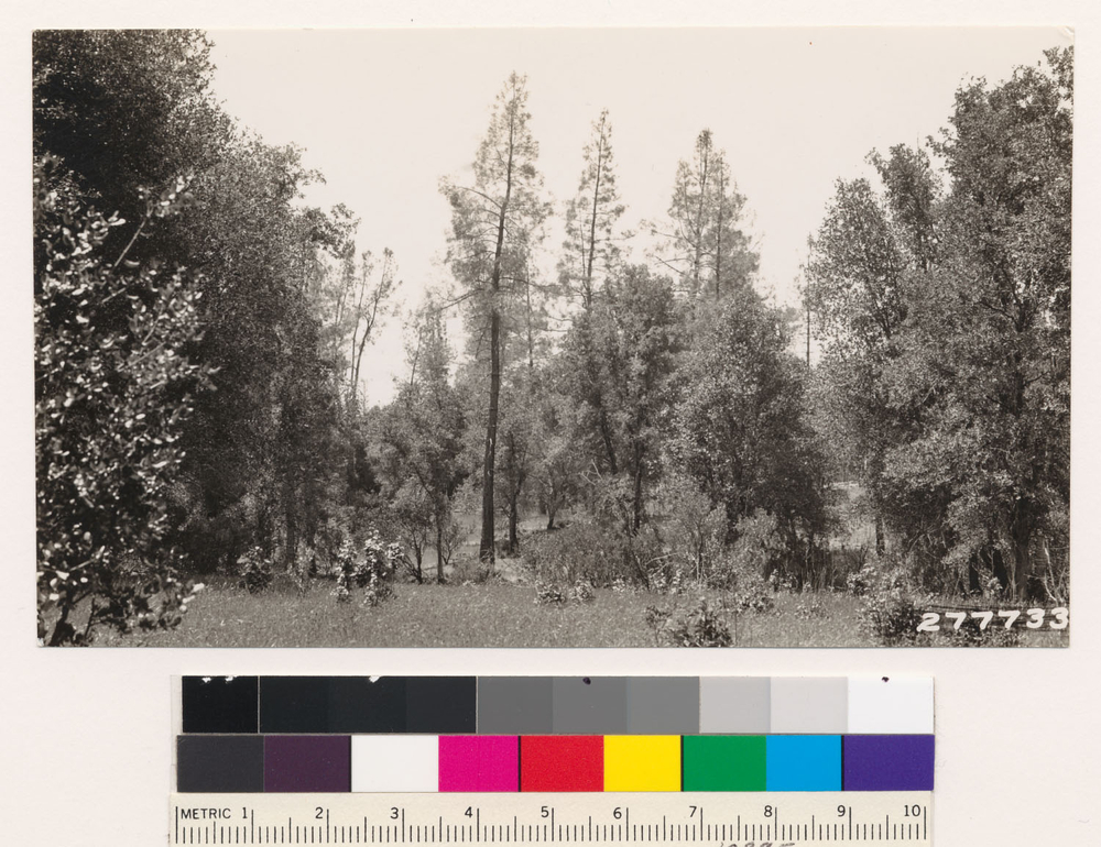
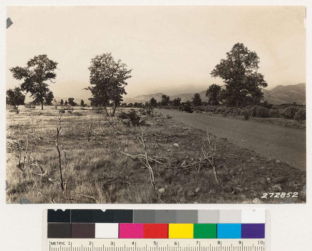
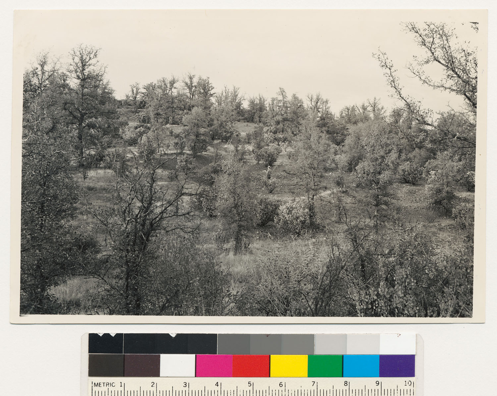
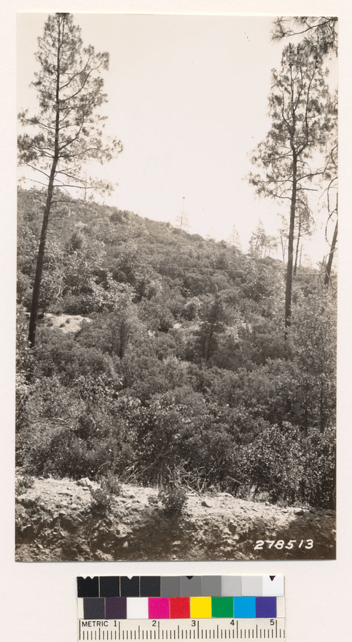
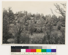
Woodland chaparral type of Douglas oak and Arctostaphylos viscida at right and woodland grass at left. This illustrates an exceptional case where burning converts the woodland chaparral to woodland grass an inversion of the normal process., T 32 N R 5 W Sec 23 Quad name: Redding. Quad number: 23. Reference to map: 6.
-
2005 The Regents of the University of California
CalPhotos
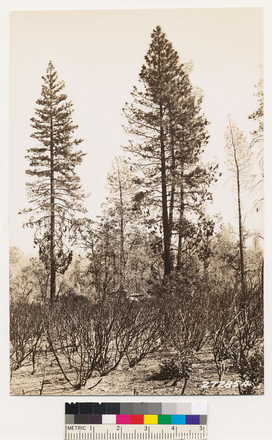
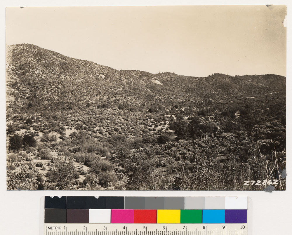
Looking S. of W at N slope of ponderosa pine, black oak and Arctostaphylos viscida., T 32 N R 5 W Sec 3, Elevation 900 Quad name: Redding. Quad number: 23. Reference to map: 9.
-
2005 The Regents of the University of California
CalPhotos
4 mile SW of Redding. Semidense shrub type of Arctostaphylos viscida. Assoc. sp.: Heteromelesarbutifolia (=Photinia arbutifolia). Shasta County., T 32 N R 5 W Sec 31 Quad name: Redding. Quad number: 23. Reference to map: 32.
-
2005 The Regents of the University of California
CalPhotos
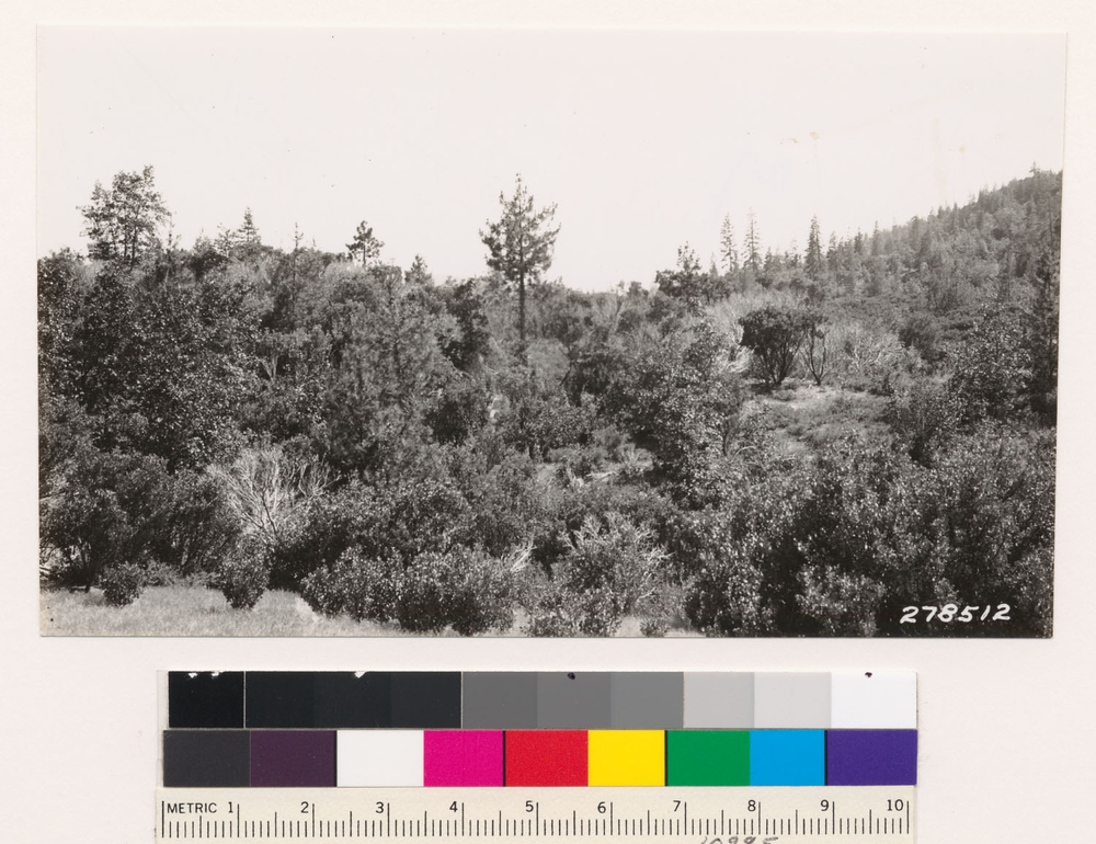
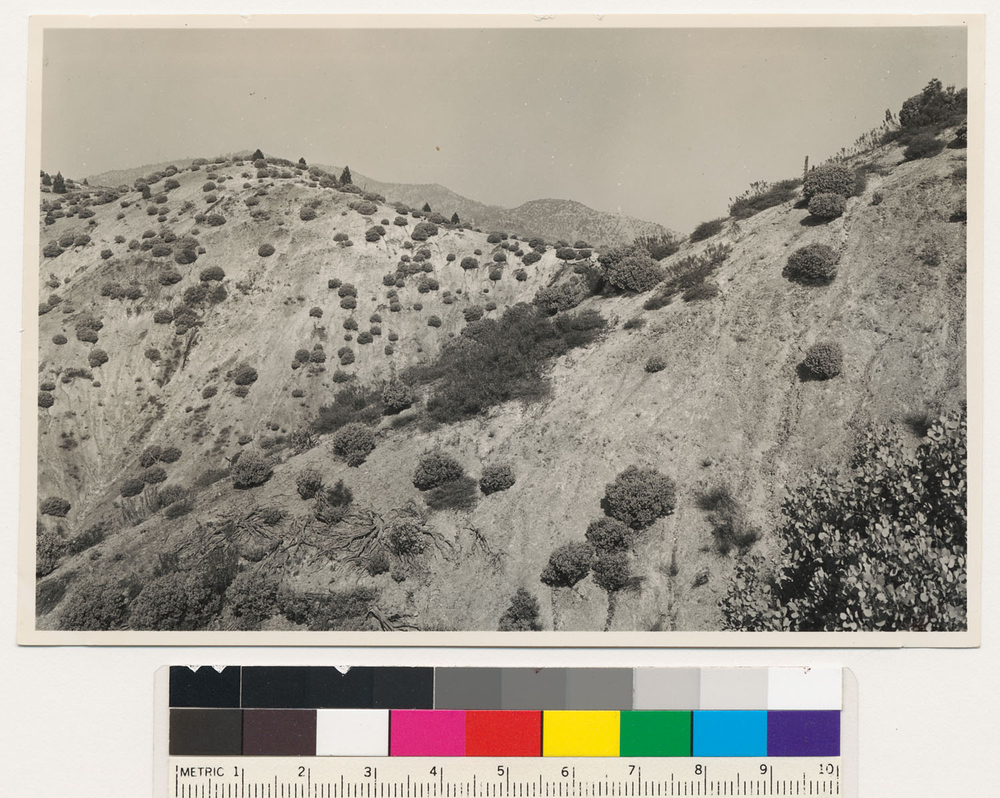
Looking SE at open chaparral type in area affected by smelter fumes. Arctostaphylos viscida, Toxicodendrondiversilobum (=Rhus diversiloba) and Ceanothus cuneatus are dominants. Type contains scattered Douglas oak and Digger pine with occasional black oak, interior live oak, Frangula californica (=Rhamnus californica) and Ceanothus tomentosa., T 32 N R 5 W Sec 32 Quad name: Redding. Quad number: 23. Reference to map: 14.
-
2005 The Regents of the University of California
CalPhotos
3 miles W of Redding. Semi dense shrub tree type of Arctostaphylos viscida-blue oak. Assoc. spp.: Quercus wislizeni, Ceanothus cuneatus. Shasta County., T 32 N R 5 W Sec 32 Quad name: Redding. Quad number: 23. Reference to map: 33.
-
2005 The Regents of the University of California
CalPhotos
3 miles W of Redding. Semidense tree shrub type of Arctostaphylos viscida-blue oak. Assoc. sp.: Quercus wislizeni, Ceanothus cuneatus. Shasta County., T 32 N R 5 W Sec 33 Quad name: Redding. Quad number: 23. Reference to map: 33.
-
2005 The Regents of the University of California
CalPhotos
3 miles west of Redding. Semidense shrub-tree type of Arctostaphylos viscida- blue oak. Assoc. sp.: Quercus wislizeni, Ceanothus cuneatus. Shasta County., T 32 N R 5 W Sec 34 Quad name: Redding. Quad number: 23. Reference to map: 33.
-
2005 The Regents of the University of California
CalPhotos
3 miles west of Redding. Open shrub tree type of Arctostaphylos viscida- blue oak. Assoc. species: Ceanothus cuneatus. Shasta County., T 32 N R 5 W Sec 35 Quad name: Redding. Quad number: 23. Reference to map: 33.
-
2005 The Regents of the University of California
CalPhotos
3 miles west of Redding. Semidense shrub-tree type of Arctostaphylos viscida- blue oak. Assoc. sp.: Quercus wislizeni, Ceanothus cuneatus. Shasta County., T 32 N R 5 W Sec 36 Quad name: Redding. Quad number: 23. Reference to map: 33.
-
2005 The Regents of the University of California
CalPhotos
15 year old Ponderosa pine growing with Arctostaphylos viscida in area denuded by smelter fumes., T 32 N R 5 W Sec 5, Elevation 800 Quad name: Redding. Quad number: 23.
-
2005 The Regents of the University of California
CalPhotos
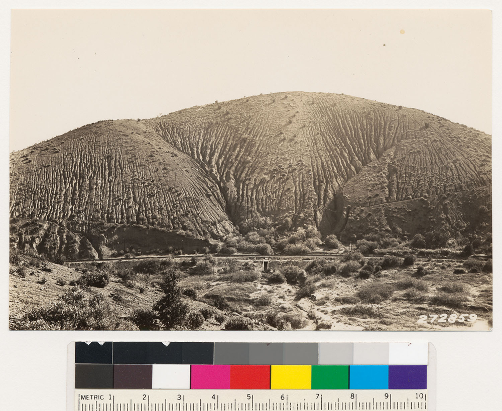
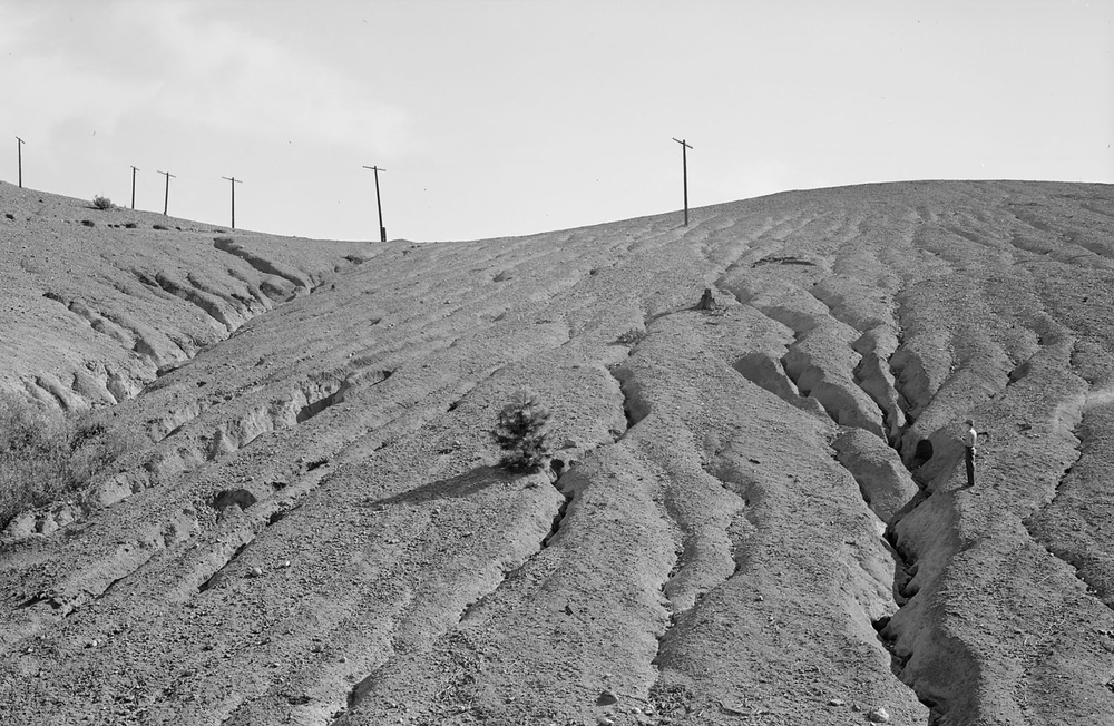
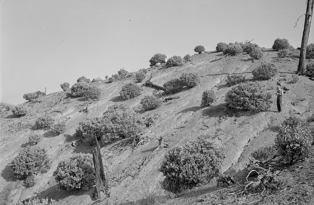
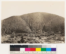
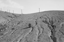
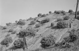
View of erosion following destruction of cover of vegetation by smelter fumes. Foreground : sparse cover of Arctostaphylos viscida and Toxicodendrondiversilobum (=Rhus diversiloba) with occasional Douglas oak, Frangula californica (=Rhamnus californica) and Ceanothus cuneatus., T 32 N R 5 W Sec 5 Quad name: Redding. Quad number: 23. Reference to map: 12.
-
2005 The Regents of the University of California
CalPhotos
Along road 1 mile W of Whiskeytown. Chaparral-woodland type with Arctostaphylos viscida, black oak and digger pine. Heteromelesarbutifolia (=Photinia arbutifolia), Quercus wislizeni and blue oak present., T 32 N R 6 W Sec 17 Quad name: Weaverville. Quad number: 24. Reference to map: 7.
-
2005 The Regents of the University of California
CalPhotos
Chaparral-woodland type with Arctostaphylos viscida, black oak and knobcone pine. Toxicodendrondiversilobum (=Rhus diversiloba) and Ceanothus perplexans (=Ceanothus lemmoni) shrub sp., T 32 N R 6 W Sec 21 Quad name: Weaverville. Quad number: 24. Reference to map: 6.
-
2005 The Regents of the University of California
CalPhotos
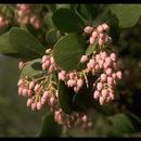
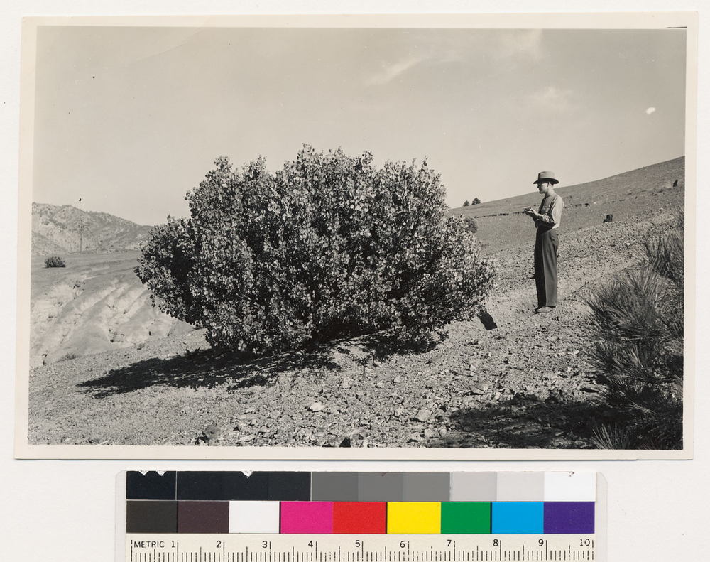
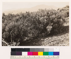
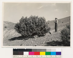
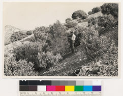
1 mile SW of Kennett. Close up of Arctostaphylos viscida to illustrate shrub element recognized on aerial photos. Shasta County., T 33 N R 5 W Sec 10 Quad name: Redding. Quad number: 23. Reference to map: 31.
-
2005 The Regents of the University of California
CalPhotos
1 mile southwest of Kennett. Bare ground included in aerial photo classification "B". Assoc. spp.: Arctostaphylos viscida, Pinus ponderosa, Salix sp. in gully. Shasta County., T 33 N R 5 W Sec 10 Quad name: Redding. Quad number: 23. Reference to map: 31.
-
2005 The Regents of the University of California
CalPhotos
2 miles SW of Kennett. Open shrub type of Arctostaphylos viscida. Shasta County., T 33 N R 5 W Sec 16 Quad name: Redding. Quad number: 23. Reference to map: 29.
-
2005 The Regents of the University of California
CalPhotos
2 miles SW of Kennett. Size of coniferous (Ponderosa pine) reproduction not recognizable from shrubs. (Arctostaphylos viscida) on aerial photos. Shasta County., T 33 N R 5 W Sec 16 Quad name: Redding. Quad number: 23.
-
2005 The Regents of the University of California
CalPhotos
Very open shrub type of Arctostaphylos viscida. Assoc. spp.: Ceanothus tomentosa, Pinus ponderosa. Shasta County., T 33 N R 5 W Sec 16 Quad name: Redding. Quad number: 23. Reference to map: 29.
-
2005 The Regents of the University of California
CalPhotos
Very open shrub type of Arctostaphylos viscida. Assoc. spp.: Ceanothus tomentosa-Pinus ponderosa. Shasta County., T 33 N R 5 W Sec 16 Quad name: Redding. Quad number: 23. Reference to map: 29.