-
Longitude (deg): -1.2. Latitude (deg): 51.4. Longitude (deg/min): 1° 10' W. Latitude (deg/min): 51° 20' N. Vice county name: Berks. Vice county no.: 22. Country: England. Identified by: Malcolm Storey. Comment: in weedy garden pond. Category: microscope photograph. Image scaling: microscope low magnification. Photographic equipment used: Nikon Coolpix 950 with Unilink adaptor on Meiji microscope.
-
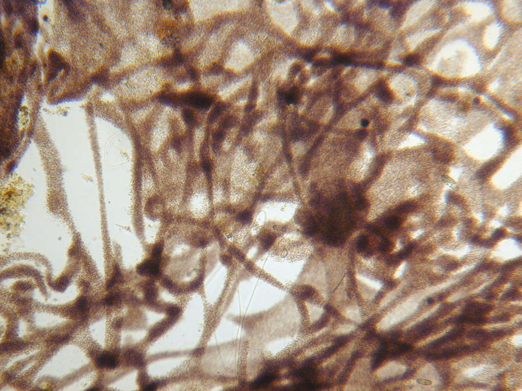
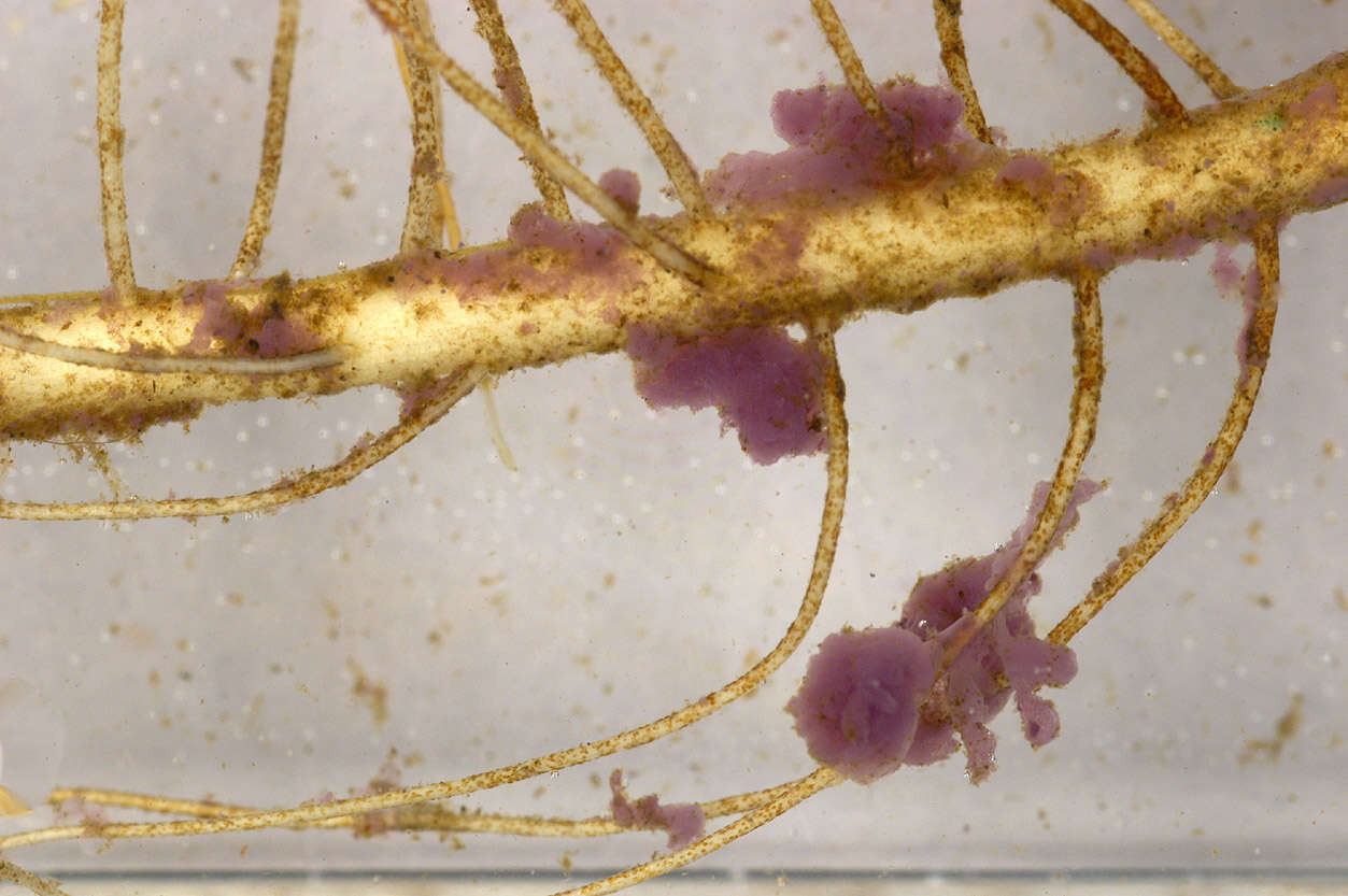
Longitude (deg): -1.2. Latitude (deg): 51.4. Longitude (deg/min): 1° 10' W. Latitude (deg/min): 51° 20' N. Vice county name: Berks. Vice county no.: 22. Country: England. Identified by: Malcolm Storey. Comment: in weedy garden pond. Category: standard photograph or close-up. Photographic equipment used: Nikon D100 dSLR with Tamron SP T90 AF Macro 1:1 lens.
-
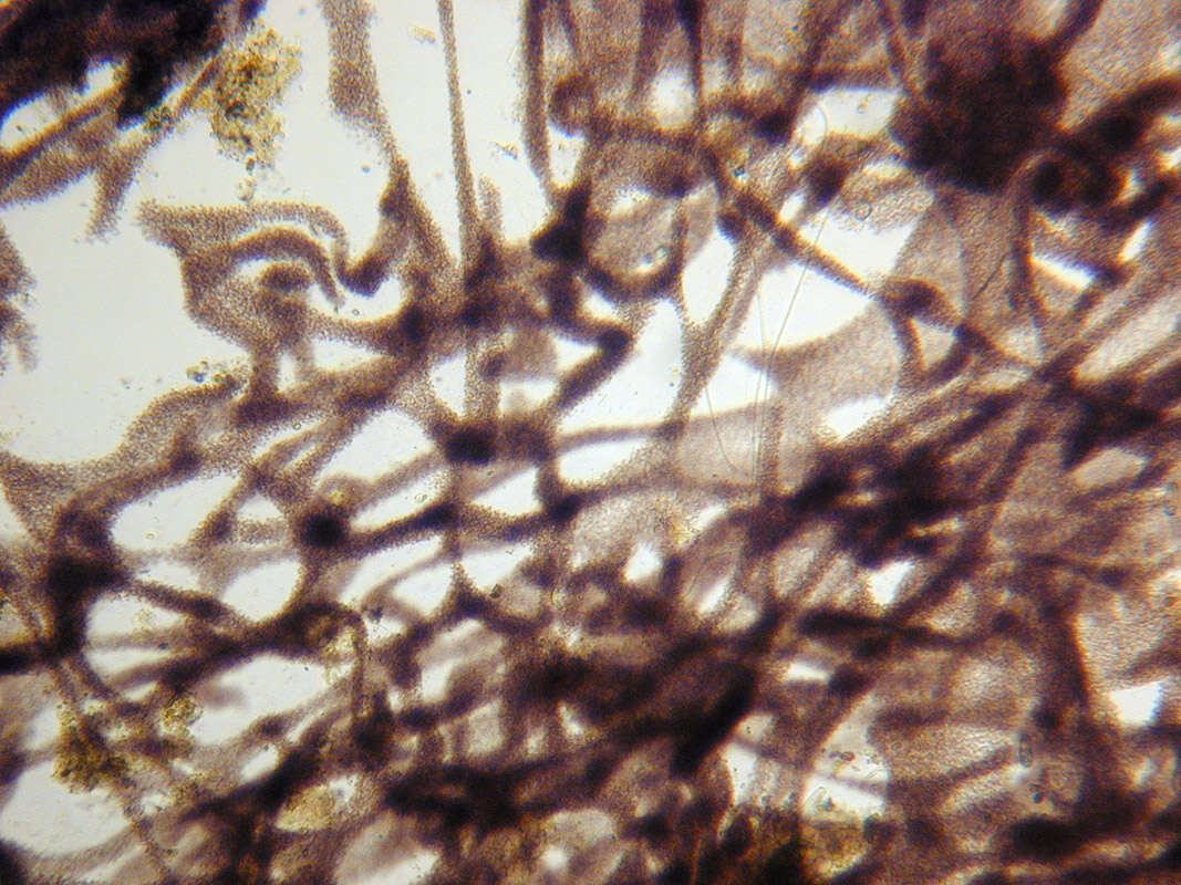
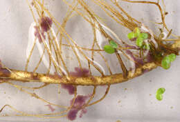
Longitude (deg): -1.2. Latitude (deg): 51.4. Longitude (deg/min): 1° 10' W. Latitude (deg/min): 51° 20' N. Vice county name: Berks. Vice county no.: 22. Country: England. Identified by: Malcolm Storey. Comment: in weedy garden pond. Category: macro-photograph. Image scaling: enlarged. Photographic equipment used: Nikon D100 dSLR with Tamron SP T90 AF Macro 1:1 lens.
-
Longitude (deg): -1.2. Latitude (deg): 51.4. Longitude (deg/min): 1° 10' W. Latitude (deg/min): 51° 20' N. Vice county name: Berks. Vice county no.: 22. Country: England. Identified by: Malcolm Storey. Comment: in weedy garden pond. Category: standard photograph or close-up. Photographic equipment used: Nikon D100 dSLR with Tamron SP T90 AF Macro 1:1 lens.
-
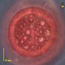
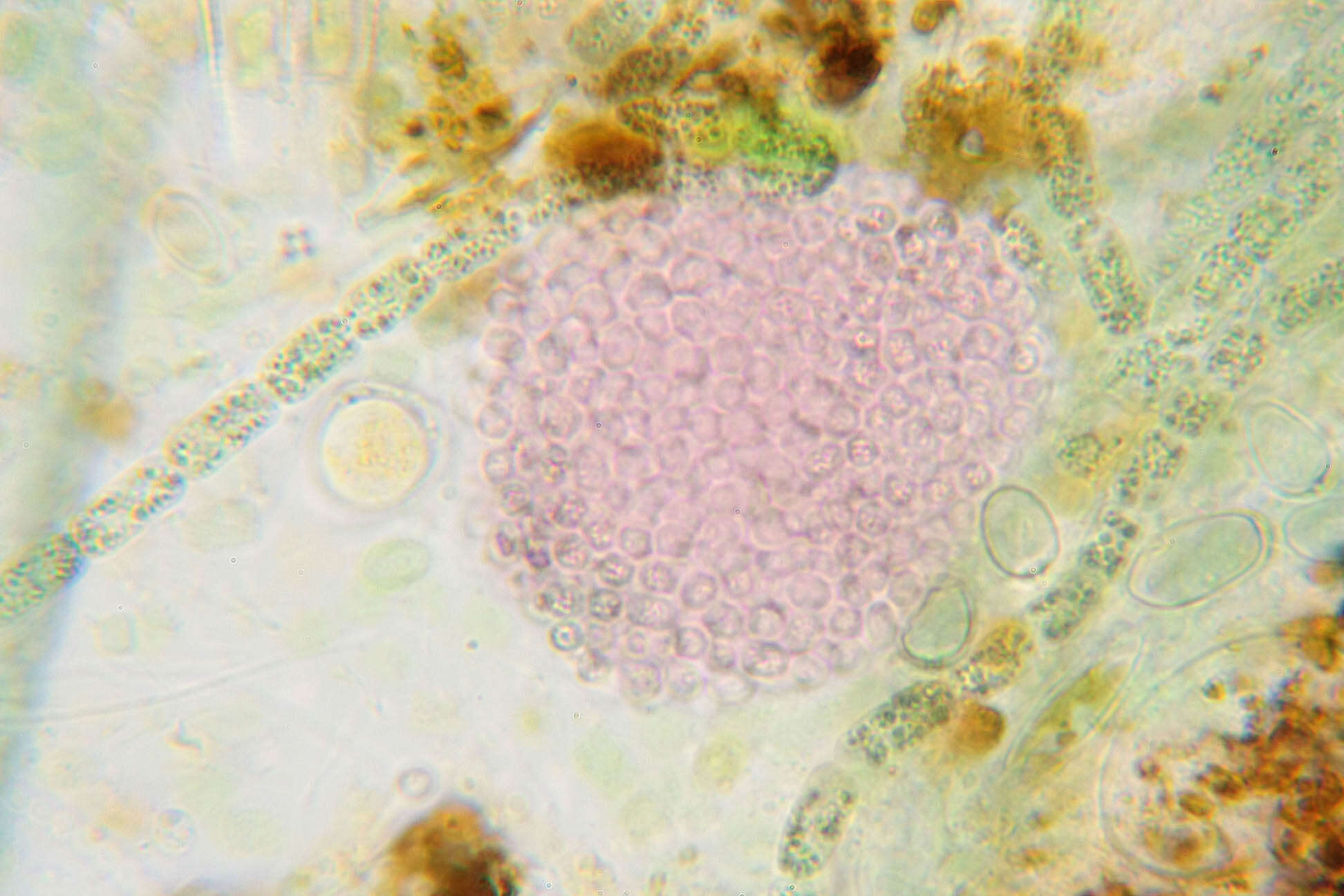
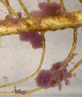
Longitude (deg): -2.8. Latitude (deg): 52.7. Longitude (deg/min): 2° 50' W. Latitude (deg/min): 52° 40' N. Vice county name: Shrops. Vice county no.: 40. Country: England. Identified by: Malcolm Storey. Comment: in artificial pond at Field Centre. Category: microscope photograph. Image scaling: highly magnified. Where photo was taken: Microscope preparation. Photographic equipment used: Canon EOS1000D dSLR and Meiji microscope with x2.5 projection eye-piece. .
-
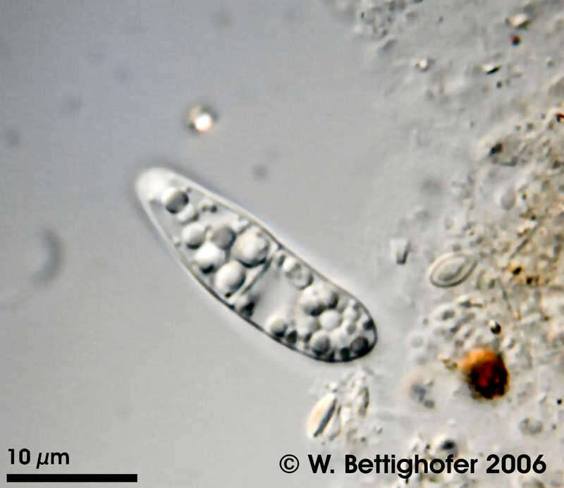
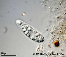
Achromatium oxaliferum Achromatium oxaliferum is a large colorless sulpher bacterium containing large refractile structures of calcite spherulites. Collected from bottom sediments of a rain storage reservoir in Kiel (Schleswig-Holstein, Germany). This image was taken using Zeiss Universal with Olympus C7070 CCD camera.Image under Creative Commons License V 3.0 (CC BY-NC-SA). Place name: Pond Demühlen, rain storage reservoir in Kiel-Russee (Schleswig-Holstein, Germany) Latitude: 54.304095 Longitude: 10.086073 Achromatium oxaliferum ist ein großes farbloses Schwefelbakterium mit großen lichtbrechenden Calziumoxalat-Kristallen. Aus Bodensedimenten eines Regenrückhaltebeckens in Kiel (Schleswig-Holstein, Germany). Mikrotechnik: Zeiss Universal, Kamera: Olympus C7070. Creative Commons License V 3.0 (CC BY-NC-SA). For permission to use of (high-resolution) images please contact postmaster@protisten.de.
-
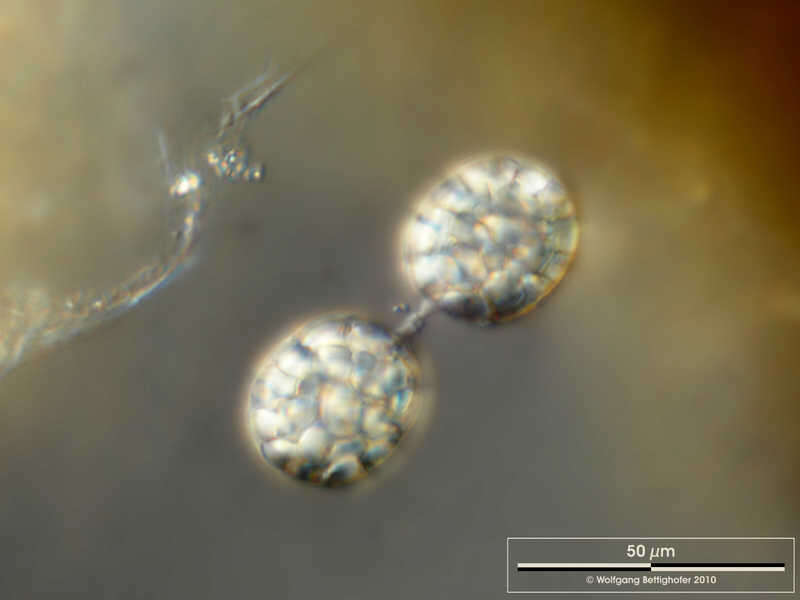
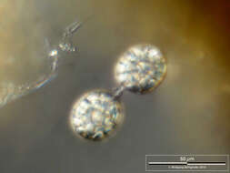
Achromatium oxaliferum Multi-layer image shows cell in conjugation sharing genetic information. Scale bar indicates 50 µm. Sample from ponds situated in the vicinity of Lake Constance. The image was built up using several photomicrographic frames with manual stacking technique. The images were taken using Zeiss Universal with Olympus C7070 CCD camera.Image under Creative Commons License V 3.0 (CC BY-NC-SA). Place name: Pond situated in the vicinity of Lake Constance (Germany) Latitude: 47.734945 Longitude: 9.091097 Die Multiebenenabbildung zeigt zwei Zellen in Konjugation (Austausch von Erbinformationen). Tiefenschärfe durch Multiebenenabbildung aus mehreren Bildebenen, manuell gestapelt. Der Messbalken markiert eine Länge von 50 µm. Probe aus einem Teich in der Nähe des Bodensees. Mikrotechnik: Zeiss Universal, Kamera: Olympus C7070. Creative Commons License V 3.0 (CC BY-NC-SA). For permission to use of (high-resolution) images please contact postmaster@protisten.de.