Grayback Mountain (15637492928)
Description :
Description: At 7,050 ft., Grayback Mountain is the tallest peak in the Josephine County. The spectacular Grayback Mountain Trail is open to hiking, horseback riding and mountain biking. The trail provides a low elevation access point to thousands of miles of trail, including the Forest Service Boundary Trail and the Pacific Crest Trail, as well as access to the Oregon Caves and the Red Buttes Wilderness. Grayback got its name in the days of the Gold Rush. Miners were often irritated by lice, or “graybacks” and named the mountain accordingly. This trail began with an idea from the Rogue Group Sierra Club. With the help of the Forest Service, the community of Williams, Oregon, and volunteers on Public Lands Day events, the Bureau of Land Management was able to construct the trail between1989 and 2006. Use Season: May-November (There is snow in the winter months and trails can become Dangerous). Fees: None Elevation: 5,000-7,050 ft. (2,055 ft. of elevation gain). Length: 6 miles on BLM land. Connects to the Forest Service Boundary trail and the O’Brien Trail. Difficulty: Moderate to Difficult Activities: Hiking, horseback riding. Driving Directions: Coming from the south: Take Highway 238 to Jacksonville and continue west, past Ruch, and into the Applegate Valley. Turn left onto Williams Highway at the Jackson/Josephine county line. Follow Williams Highway about 4 miles to a three-way intersection with Water Gap Road and turn left. Follow Water Gap Road through “downtown” Williams to a “Y” junction and turn left onto East Fork Road. Follow East Fork Road for about 3 miles to Rock Creek Road, which is also BLM Road 39-5-14. Continue up this road for approximately two miles until you reach a BLM sign. Park in the gravel pullout area. From the North: Get off at the Grants Pass exit. Go south on US199 and turn left on SR238 towards Murphy and Applegate. The road forks, continue straight onto Water Gap Rd towards Williams. Take a left on East Forks Rd by the Williams Country Store. Take a right on Rock Creek Road, which is also BLM Road 39-5 14. Continue up this road for Approximately two miles until you reach a BLM sign on your right. Park in the gravel pullout area. For more information head on over to: www.blm.gov/or/resources/recreation/site_info.php?siteid=367. Date: 11 August 2012, 14:40. Source: Grayback Mountain. Author: Bureau of Land Management Oregon and Washington.
Inclus dans les pages suivantes :
- Life
- Cellular (Organismes cellulaires)
- Eukaryota (eucaryotes)
- Opisthokonta
- Metazoa (animaux)
- Bilateria
- Deuterostomia (Deutérostomes)
- Chordata (Chordés)
- Vertebrata (vertébrés)
- Gnathostomata
- Osteichthyes
- Sarcopterygii (Sarcoptérygiens)
- Tetrapoda
- Lissamphibia (Amphibiens)
- Anura (anoures)
- Hylidae
- Acridinae
- Pseudacris
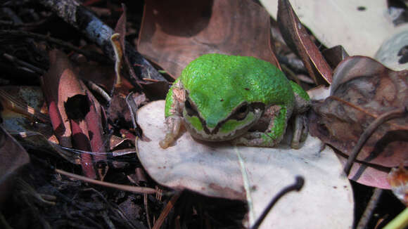
- Pseudacris regilla (Rainette du Pacifique)
Cette image ne figure dans aucune collection.
Informations sur la provenance
- licence
- cc-by-3.0
- droit d’auteur
- Bureau of Land Management Oregon and Washington
- original
- fichier de média d’origine
- visiter la source
- site partenaire
- Wikimedia Commons
- ID
.jpg)
.jpg)